|
search place name
|
||
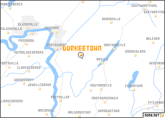
Durkeetown (New York, United States - USA)Durkeetown is a town in the New York region of United States - USA. An overview map of the region around Durkeetown is displayed below.
regional and 3d topo map of Durkeetown, United States - USA ::
Durkeetown airports ::
The nearest airport is ALB - Albany Intl, located 59.6 km south of Durkeetown.
Other airports nearby include BTV - Burlington Intl (139.5 km north), CEF - Chicopee Falls Westover Arb Metropolitan (142.7 km south east), BDL - Windsor Locks Bradley Intl (161.1 km south east), HFD - Hartford Brainard (182.8 km south east), Nearby towns ::
Argyle (3.5km east) //
Fort Edward (4.8km north west) //
Lick Springs (7.2km south) //
North Argyle (5.8km north east) //
South Argyle (7.6km south east) //
Hudson Falls (7.4km north west) //
Fenimore (8.0km north west) //
Adamsville (9.5km north east) //
[all distances 'as the bird flies' and approximate]  Places with similar names to Durkeetown, United States - USA ::
// Tirguitine (MA)
// Daragutan (PH)
// Turkeytown (US)
// Truckton (US)
// Dreikutten (DE)
// Draketown (US)
// Dragodena (IT)
// Torgauten (NO)
// Tregtan (AL)
// Dragodan (BG)
Disclaimer :: Information on this page comes without warranty of any kind |
||
|
Where is Durkeetown? Elevation and coordinates ::
Latitude (lat): 43°14'48"N Longitude (lon): 73°31'58"W
Elevation (approx.): 46m (map arrows pan, magnifying glasses zoom) |
||
|
Visiting Durkeetown? Hotel/Accommodation ::
Book a hotel in Durkeetown Travel Guide ::
rental cars ::
car rental offers GPS waypoint ::
download a GPX waypoint (PoI) of Durkeetown for your GPS receiver
|
||