|
search place name
|
||
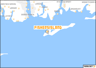
Fishers Island (New York, United States - USA)Fishers Island is a town in the New York region of United States - USA. An overview map of the region around Fishers Island is displayed below.
regional and 3d topo map of Fishers Island, United States - USA ::
Fishers Island airports ::
The nearest airport is PVD - Providence Theodore Francis Green State, located 73.0 km north east of Fishers Island.
Other airports nearby include HFD - Hartford Brainard (74.6 km north west), BDR - Stratford Igor I Sikorsky Mem (93.0 km west), BDL - Windsor Locks Bradley Intl (93.6 km north west), ISP - Islip Long Island Mac Arthur (104.0 km south west), Nearby towns ::
Groton Long Point (6.5km north) //
Noank (8.4km north) //
Osprey Beach (8.7km north west) //
[all distances 'as the bird flies' and approximate] 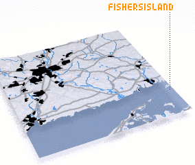 Places with similar names to Fishers Island, United States - USA :: Disclaimer :: Information on this page comes without warranty of any kind |
||
|
Where is Fishers Island? Elevation and coordinates ::
Latitude (lat): 41°15'25"N Longitude (lon): 72°1'28"W
Elevation (approx.): 14m (map arrows pan, magnifying glasses zoom) |
||
|
Visiting Fishers Island? Hotel/Accommodation ::
Book a hotel in Fishers Island Travel Guide ::
rental cars ::
car rental offers GPS waypoint ::
download a GPX waypoint (PoI) of Fishers Island for your GPS receiver
|
||