|
search place name
|
||
Flower Hill (New York, United States - USA)Flower Hill is a town in the New York region of United States - USA. An overview map of the region around Flower Hill is displayed below.
regional and 3d topo map of Flower Hill, United States - USA ::

Flower Hill airports ::
The nearest airport is LGA - New York La Guardia, located 16.5 km west of Flower Hill.
Other airports nearby include JFK - New York John F Kennedy Intl (20.3 km south west), HPN - White Plains Westchester Co (28.9 km north), TEB - Teterboro (32.3 km west), EWR - Newark Liberty Intl (43.1 km west), Nearby towns ::
Munsey Park (1.0km south) //
Strathmore (1.7km south) //
Plandome Manor (1.7km north west) //
Manhasset (1.9km south west) //
Plandome (1.9km west) //
Plandome Heights (2.0km west) //
Roslyn Estates (2.3km south east) //
Port Washington (2.5km north west) //
North Hills (3.0km south) //
Baxter Estates (3.3km north) //
Roslyn (2.7km east) //
South Glenwood Landing (3.4km north east) //
Roslyn Heights (3.5km south east) //
Thomaston (3.6km south west) //
Searingtown (4.2km south east) //
East Garden City (3.6km west) //
Port Washington North (4.5km north west) //
Kensington (3.8km south west) //
Roslyn Harbor (3.9km east) //
Great Neck (4.0km west) //
Manhasset Hills (5.3km south) //
Glenwood Landing (4.4km north east) //
Manorhaven (4.9km north west) //
Great Neck Plaza (4.4km south west) //
Russell Gardens (4.7km south west) //
Albertson (4.9km south east) //
University Gardens (4.8km south west) //
Lake Success (5.1km south west) //
Greenvale (4.5km east) //
[all distances 'as the bird flies' and approximate] 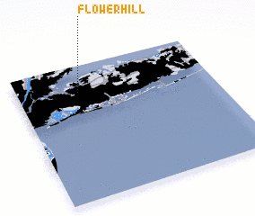 Places with similar names to Flower Hill, United States - USA ::
Disclaimer :: Information on this page comes without warranty of any kind |
||
|
Where is Flower Hill? Elevation and coordinates ::
Latitude (lat): 40°48'26"N Longitude (lon): 73°40'54"W
Elevation (approx.): 55m (map arrows pan, magnifying glasses zoom) |
||
|
Visiting Flower Hill? Hotel/Accommodation ::
Book a hotel in Flower Hill Travel Guide ::
rental cars ::
car rental offers GPS waypoint ::
download a GPX waypoint (PoI) of Flower Hill for your GPS receiver
|
||