|
search place name
|
||
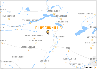
Glasgow Mills (New York, United States - USA)Glasgow Mills is a town in the New York region of United States - USA. An overview map of the region around Glasgow Mills is displayed below.
regional and 3d topo map of Glasgow Mills, United States - USA ::
Glasgow Mills airports ::
The nearest airport is ALB - Albany Intl, located 71.4 km south east of Glasgow Mills.
Other airports nearby include SYR - Syracuse Hancock Intl (128.2 km west), GTB - Fort Drum Wheeler Sack Aaf (142.9 km north west), ART - Watertown Intl (155.8 km north west), SWF - Newburgh Stewart Intl (181.0 km south), Nearby towns ::
Newkirk (2.1km north east) //
Bradtville (3.9km south east) //
North Bush (3.7km south east) //
Rockwood (5.4km south east) //
Dempster Corners (4.4km west) //
Scotchbrush (4.9km south west) //
Garoga (6.6km south) //
Caroga Lake (5.6km north east) //
Wheelerville (7.0km north east) //
Canada Lake (8.1km north) //
Stewart Landing (6.7km north west) //
Lassellsville (8.2km south west) //
Cork (8.6km south east) //
[all distances 'as the bird flies' and approximate] 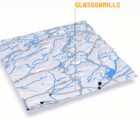 Places with similar names to Glasgow Mills, United States - USA :: Disclaimer :: Information on this page comes without warranty of any kind |
||
|
Where is Glasgow Mills? Elevation and coordinates ::
Latitude (lat): 43°6'10"N Longitude (lon): 74°31'52"W
Elevation (approx.): 489m (map arrows pan, magnifying glasses zoom) |
||
|
Visiting Glasgow Mills? Hotel/Accommodation ::
Book a hotel in Glasgow Mills Travel Guide ::
rental cars ::
car rental offers GPS waypoint ::
download a GPX waypoint (PoI) of Glasgow Mills for your GPS receiver
|
||