|
search place name
|
||
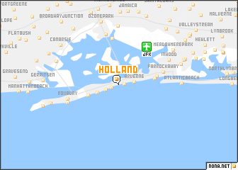
Holland (New York, United States - USA)Holland is a town in the New York region of United States - USA. An overview map of the region around Holland is displayed below.
regional and 3d topo map of Holland, United States - USA ::
nearby GPS traces from timatio ::
Holland airports ::
The nearest airport is JFK - New York John F Kennedy Intl, located 6.8 km north east of Holland.
Other airports nearby include LGA - New York La Guardia (21.7 km north), EWR - Newark Liberty Intl (31.9 km west), TEB - Teterboro (35.7 km north west), HPN - White Plains Westchester Co (54.2 km north), Nearby towns ::
Hammel (0.7km east) //
Seaside (0.9km south west) //
Broad Channel (1.9km north) //
Rockaway Park (1.7km south west) //
Arverne (1.9km east) //
Belle Harbor (2.8km south west) //
Neponsit (4.0km south west) //
Edgemere (4.4km east) //
Wave Crest (4.8km east) //
Far Rockaway (5.7km east) //
Hamilton Beach (7.4km north) //
Howard Beach (8.1km north) //
Roxbury (6.5km west) //
Fort Tilden (6.7km south west) //
Inwood (7.2km north east) //
Meadowmere Park (8.5km north east) //
[all distances 'as the bird flies' and approximate]  Places with similar names to Holland, United States - USA ::
Disclaimer :: Information on this page comes without warranty of any kind |
||
|
Where is Holland? Elevation and coordinates ::
Latitude (lat): 40°35'11"N Longitude (lon): 73°49'6"W
Elevation (approx.): 5m (map arrows pan, magnifying glasses zoom) |
||
|
Visiting Holland? Hotel/Accommodation ::
Book a hotel in Holland Travel Guide ::
rental cars ::
car rental offers GPS waypoint ::
download a GPX waypoint (PoI) of Holland for your GPS receiver
|
||