|
search place name
|
||
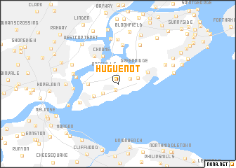
Huguenot (New York, United States - USA)Huguenot is a town in the New York region of United States - USA. An overview map of the region around Huguenot is displayed below.
regional and 3d topo map of Huguenot, United States - USA ::
Huguenot airports ::
The nearest airport is EWR - Newark Liberty Intl, located 17.4 km north of Huguenot.
Other airports nearby include TEB - Teterboro (36.5 km north), JFK - New York John F Kennedy Intl (37.0 km east), LGA - New York La Guardia (38.1 km north east), NEL - Lakehurst Naes (57.5 km south), Nearby towns ::
Woodrow (0.7km north) //
Princes Bay (1.0km south) //
Annadale (1.7km north east) //
Pleasant Plains (2.3km south west) //
Rossville (2.6km north west) //
Fresh Kills (3.1km north) //
Eltingville (2.6km east) //
Greenridge (3.4km north east) //
Richmond Valley (3.5km south west) //
Charleston (3.6km west) //
Chrome (4.7km north west) //
Great Kills (4.1km north east) //
Carteret (5.3km north west) //
Travis (6.2km north) //
Tottenville (5.5km south west) //
Boynton Beach (5.2km west) //
Chelsea (7.0km north) //
Barber (5.4km west) //
New Springville (6.8km north east) //
Tremley Point (7.2km north) //
Sewaren (5.7km west) //
Port Reading (6.4km north west) //
Oakwood Heights Station (6.5km north east) //
Maurer (6.3km west) //
Bulls Head (8.2km north) //
Bloomfield (8.5km north) //
West Carteret (7.7km north west) //
Perth Amboy (6.9km south west) //
Grasselli (8.7km north) //
[all distances 'as the bird flies' and approximate]  Places with similar names to Huguenot, United States - USA ::
Disclaimer :: Information on this page comes without warranty of any kind |
||
|
Where is Huguenot? Elevation and coordinates ::
Latitude (lat): 40°32'14"N Longitude (lon): 74°11'42"W
Elevation (approx.): 34m (map arrows pan, magnifying glasses zoom) |
||
|
Visiting Huguenot? Hotel/Accommodation ::
Book a hotel in Huguenot Travel Guide ::
rental cars ::
car rental offers GPS waypoint ::
download a GPX waypoint (PoI) of Huguenot for your GPS receiver
|
||