|
search place name
|
||
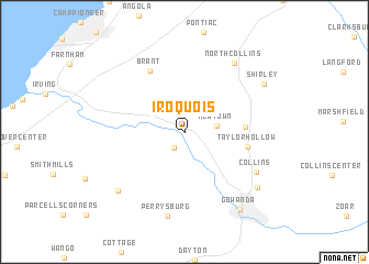
Iroquois (New York, United States - USA)Iroquois is a town in the New York region of United States - USA. An overview map of the region around Iroquois is displayed below.
regional and 3d topo map of Iroquois, United States - USA ::
Iroquois airports ::
The nearest airport is BUF - Buffalo Niagara Intl, located 49.8 km north east of Iroquois.
Other airports nearby include IAG - Niagara Falls Intl (63.9 km north), YHM - Hamilton (105.3 km north west), ROC - Greater Rochester Intl (125.6 km north east), YTZ - Toronto City Centre (126.1 km north), Nearby towns ::
Versailles (1.7km south west) //
Newtown (2.5km east) //
Lawtons (4.5km east) //
Taylor Hollow (4.9km east) //
Brant (6.7km north west) //
Collins (6.7km south east) //
North Collins (7.9km north east) //
Perrysburg (8.6km south) //
West Perrysburg (7.7km south west) //
Bagdad (7.7km south east) //
Shirley (7.7km north east) //
Gowanda (8.8km south east) //
[all distances 'as the bird flies' and approximate]  Places with similar names to Iroquois, United States - USA ::
Disclaimer :: Information on this page comes without warranty of any kind |
||
|
Where is Iroquois? Elevation and coordinates ::
Latitude (lat): 42°31'58"N Longitude (lon): 78°59'10"W
Elevation (approx.): 208m (map arrows pan, magnifying glasses zoom) |
||
|
Visiting Iroquois? Hotel/Accommodation ::
Book a hotel in Iroquois Travel Guide ::
rental cars ::
car rental offers GPS waypoint ::
download a GPX waypoint (PoI) of Iroquois for your GPS receiver
|
||