|
search place name
|
||
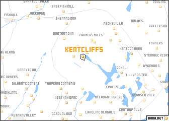
Kent Cliffs (New York, United States - USA)Kent Cliffs is a town in the New York region of United States - USA. An overview map of the region around Kent Cliffs is displayed below.
regional and 3d topo map of Kent Cliffs, United States - USA ::
Kent Cliffs airports ::
The nearest airport is SWF - Newburgh Stewart Intl, located 29.8 km west of Kent Cliffs.
Other airports nearby include HPN - White Plains Westchester Co (43.3 km south), BDR - Stratford Igor I Sikorsky Mem (61.8 km south east), TEB - Teterboro (71.9 km south), LGA - New York La Guardia (75.9 km south), Nearby towns ::
Allen Corners (1.8km north) //
Richardsville (2.0km north west) //
Meads Corners (3.4km north) //
Carmel Park Estates (4.4km north) //
Farmers Mills (4.7km north) //
Mahopac Mines (6.3km south) //
Hortontown (5.9km north west) //
Berkshire Terrace (6.3km north east) //
Bullet Hole (7.8km south) //
Tompkins Corners (7.4km south west) //
Carmel (6.8km south east) //
Kent Hills (7.4km north east) //
Shenandoah (8.7km north) //
Ludingtonville (8.0km north east) //
Crafts (8.4km south east) //
Pecksville (8.6km north east) //
[all distances 'as the bird flies' and approximate] 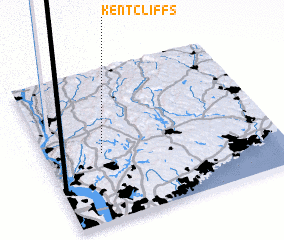 Places with similar names to Kent Cliffs, United States - USA :: Disclaimer :: Information on this page comes without warranty of any kind |
||
|
Where is Kent Cliffs? Elevation and coordinates ::
Latitude (lat): 41°27'18"N Longitude (lon): 73°45'16"W
Elevation (approx.): 220m (map arrows pan, magnifying glasses zoom) |
||
|
Visiting Kent Cliffs? Hotel/Accommodation ::
Book a hotel in Kent Cliffs Travel Guide ::
rental cars ::
car rental offers GPS waypoint ::
download a GPX waypoint (PoI) of Kent Cliffs for your GPS receiver
|
||