|
search place name
|
||
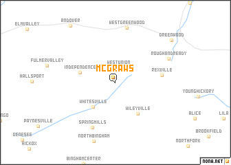
McGraws (New York, United States - USA)McGraws is a town in the New York region of United States - USA. An overview map of the region around McGraws is displayed below.
regional and 3d topo map of McGraws, United States - USA ::
McGraws airports ::
The nearest airport is IPT - Williamsport Rgnl, located 114.3 km south east of McGraws.
Other airports nearby include ROC - Greater Rochester Intl (116.2 km north), BUF - Buffalo Niagara Intl (126.7 km north west), IAG - Niagara Falls Intl (152.2 km north west), SYR - Syracuse Hancock Intl (176.2 km north east), Nearby towns ::
West Union (2.4km north) //
Barney Mills (2.9km north east) //
Whitesville (4.8km south west) //
Independence (4.6km west) //
Wileyville (5.8km south east) //
Rexville (5.7km east) //
Spring Mills (7.8km south) //
Rough and Ready (7.4km north east) //
[all distances 'as the bird flies' and approximate]  Places with similar names to McGraws, United States - USA ::
// Maccarese (IT)
// McGuires (US)
// McCrays (US)
// Muck Cross (US)
// Moca-Croce (FR)
// McGraws (US)
Disclaimer :: Information on this page comes without warranty of any kind |
||
|
Where is McGraws? Elevation and coordinates ::
Latitude (lat): 42°4'24"N Longitude (lon): 77°43'48"W
Elevation (approx.): 585m (map arrows pan, magnifying glasses zoom) |
||
|
Visiting McGraws? Hotel/Accommodation ::
Book a hotel in McGraws Travel Guide ::
rental cars ::
car rental offers GPS waypoint ::
download a GPX waypoint (PoI) of McGraws for your GPS receiver
|
||