|
search place name
|
||
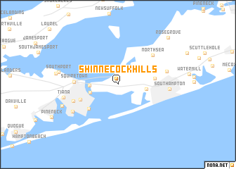
Shinnecock Hills (New York, United States - USA)Shinnecock Hills is a town in the New York region of United States - USA. An overview map of the region around Shinnecock Hills is displayed below.
regional and 3d topo map of Shinnecock Hills, United States - USA ::
Shinnecock Hills airports ::
The nearest airport is ISP - Islip Long Island Mac Arthur, located 54.7 km west of Shinnecock Hills.
Other airports nearby include BDR - Stratford Igor I Sikorsky Mem (63.4 km north west), HFD - Hartford Brainard (95.2 km north), HPN - White Plains Westchester Co (106.5 km west), JFK - New York John F Kennedy Intl (114.5 km west), Nearby towns ::
Canoe Place (3.4km west) //
Newtown (3.5km west) //
Art Village (3.5km east) //
Tuckahoe (4.5km east) //
Ponquogue (5.2km south west) //
Hampton Bays (5.1km south west) //
Squiretown (5.3km west) //
North Sea (6.2km north east) //
Springville (6.0km south west) //
Hampton Park (6.2km east) //
Southampton (6.3km east) //
Rampasture (7.0km south west) //
Tiana (6.9km west) //
West Tiana (7.6km south west) //
Rose Grove (9.5km north east) //
[all distances 'as the bird flies' and approximate]  Places with similar names to Shinnecock Hills, United States - USA :: Disclaimer :: Information on this page comes without warranty of any kind |
||
|
Where is Shinnecock Hills? Elevation and coordinates ::
Latitude (lat): 40°53'27"N Longitude (lon): 72°27'51"W
Elevation (approx.): 20m (map arrows pan, magnifying glasses zoom) |
||
|
Visiting Shinnecock Hills? Hotel/Accommodation ::
Book a hotel in Shinnecock Hills Travel Guide ::
rental cars ::
car rental offers GPS waypoint ::
download a GPX waypoint (PoI) of Shinnecock Hills for your GPS receiver
|
||