|
search place name
|
||
State Line (New York, United States - USA)State Line is a town in the New York region of United States - USA. An overview map of the region around State Line is displayed below.
regional and 3d topo map of State Line, United States - USA ::

State Line airports ::
The nearest airport is YHM - Hamilton, located 104.2 km north of State Line.
Other airports nearby include BUF - Buffalo Niagara Intl (114.4 km north east), IAG - Niagara Falls Intl (116.7 km north east), YNG - Youngstown Warren Rgnl (133.4 km south west), YXU - London (144.3 km north west), Nearby towns ::
Kerrs Corners (4.5km south) //
Ripley (4.7km north east) //
South Ripley (6.3km south east) //
Orchard Beach (5.8km west) //
Wattlesburg (6.1km east) //
Freeport (6.1km west) //
North East (7.0km south west) //
[all distances 'as the bird flies' and approximate] 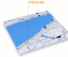 Places with similar names to State Line, United States - USA ::
// State Line (US)
// State Line (US)
// State Line (US)
// State Line (US)
// Stadeln (DE)
// Stadeln (DE)
// Stodolno (PL)
// Soto de Luiña (ES)
// State Line (US)
// State Line (US)
Disclaimer :: Information on this page comes without warranty of any kind |
||
|
Where is State Line? Elevation and coordinates ::
Latitude (lat): 42°14'40"N Longitude (lon): 79°45'32"W
Elevation (approx.): 236m (map arrows pan, magnifying glasses zoom) |
||
|
Visiting State Line? Hotel/Accommodation ::
Book a hotel in State Line Travel Guide ::
rental cars ::
car rental offers GPS waypoint ::
download a GPX waypoint (PoI) of State Line for your GPS receiver
|
||