|
search place name
|
||
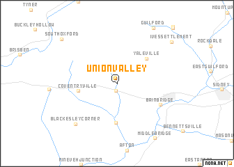
Union Valley (New York, United States - USA)Union Valley is a town in the New York region of United States - USA. An overview map of the region around Union Valley is displayed below.
regional and 3d topo map of Union Valley, United States - USA ::
Union Valley airports ::
The nearest airport is SYR - Syracuse Hancock Intl, located 98.9 km north west of Union Valley.
Other airports nearby include SWF - Newburgh Stewart Intl (150.1 km south east), ALB - Albany Intl (150.5 km east), IPT - Williamsport Rgnl (166.1 km south west), ART - Watertown Intl (189.3 km north), Nearby towns ::
West Bainbridge (1.2km south) //
Yaleville (5.3km north east) //
North Afton (6.3km south) //
Coventryville (4.8km west) //
Bainbridge (6.2km south east) //
Blackesley Corner (8.1km south west) //
Guilford (9.9km north east) //
Middle Bridge (9.8km south east) //
Ives Settlement (9.3km north east) //
South Oxford (9.6km north west) //
Parker (10.9km north east) //
[all distances 'as the bird flies' and approximate] 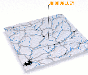 Places with similar names to Union Valley, United States - USA ::
// Union Valley (US)
// Unionville (US)
// Unionville (US)
// Unionville (US)
// Unionville (US)
// Unionville (US)
// Unionville (US)
// Unionville (US)
// Unionville (US)
// Unionville (US)
Disclaimer :: Information on this page comes without warranty of any kind |
||
|
Where is Union Valley? Elevation and coordinates ::
Latitude (lat): 42°19'27"N Longitude (lon): 75°32'32"W
Elevation (approx.): 408m (map arrows pan, magnifying glasses zoom) |
||
|
Visiting Union Valley? Hotel/Accommodation ::
Book a hotel in Union Valley Travel Guide ::
rental cars ::
car rental offers GPS waypoint ::
download a GPX waypoint (PoI) of Union Valley for your GPS receiver
|
||