|
search place name
|
||
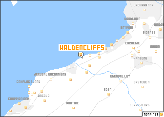
Walden Cliffs (New York, United States - USA)Walden Cliffs is a town in the New York region of United States - USA. An overview map of the region around Walden Cliffs is displayed below.
regional and 3d topo map of Walden Cliffs, United States - USA ::
Walden Cliffs airports ::
The nearest airport is BUF - Buffalo Niagara Intl, located 29.9 km north east of Walden Cliffs.
Other airports nearby include IAG - Niagara Falls Intl (42.4 km north), YHM - Hamilton (94.4 km north west), YTZ - Toronto City Centre (106.5 km north), ROC - Greater Rochester Intl (113.2 km north east), Nearby towns ::
Pinehurst (1.5km north east) //
Lake View (2.0km south east) //
North Evans (3.3km south) //
Highland-on-the-Lake (2.9km south west) //
Weyer (2.9km east) //
Clifton Heights (3.1km east) //
Derby (5.3km south) //
Wanakah (4.6km north east) //
Clover Bank (5.6km north east) //
Mount Vernon (5.9km north east) //
Jerusalem Corners (7.0km south west) //
Locksley Park (7.2km north east) //
Eden (9.3km south east) //
Eden Valley (8.3km south east) //
[all distances 'as the bird flies' and approximate] 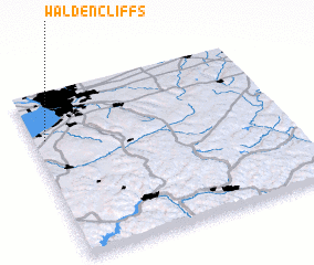 Places with similar names to Walden Cliffs, United States - USA :: Disclaimer :: Information on this page comes without warranty of any kind |
||
|
Where is Walden Cliffs? Elevation and coordinates ::
Latitude (lat): 42°43'32"N Longitude (lon): 78°57'6"W
Elevation (approx.): 200m (map arrows pan, magnifying glasses zoom) |
||
|
Visiting Walden Cliffs? Hotel/Accommodation ::
Book a hotel in Walden Cliffs Travel Guide ::
rental cars ::
car rental offers GPS waypoint ::
download a GPX waypoint (PoI) of Walden Cliffs for your GPS receiver
|
||