|
search place name
|
||
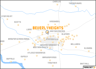
Beverly Heights (North Carolina, United States - USA)Beverly Heights is a town in the North Carolina region of United States - USA. An overview map of the region around Beverly Heights is displayed below.
regional and 3d topo map of Beverly Heights, United States - USA ::
Beverly Heights airports ::
The nearest airport is HKY - Hickory Rgnl, located 44.5 km west of Beverly Heights.
Other airports nearby include CLT - Charlotte Douglas Intl (66.1 km south), INT - Winston-salem Smith Reynolds (71.3 km north east), POB - Fayetteville Pope Afb (185.5 km east), SSC - Sumter Shaw Afb (207.6 km south), Nearby towns ::
Lakeside (1.1km south east) //
Starmount (1.2km south) //
Northview (1.7km east) //
Wendover Hills (1.9km south west) //
Monticello Heights (1.9km west) //
Northmont (2.0km north west) //
Bloomfield (2.3km south west) //
Statesville (3.3km south east) //
Monticello (3.0km west) //
Chipley Park (3.8km north) //
Eastover Acres (3.1km east) //
Statesville West (3.6km south west) //
Greencrest (3.6km south west) //
Brookgreen (3.3km east) //
Iredell Heights (4.2km north east) //
Kingswood (4.5km north east) //
Bristol Terrace (4.3km south west) //
Sherwood Forest (4.4km north east) //
Berkshire Hills (4.6km south east) //
Westover (4.5km south west) //
Washington Heights (5.3km south) //
Foxcroft Apartments (4.8km south east) //
Eastside (4.6km south east) //
Signal Hill Apartments (4.8km east) //
Green Acres (5.1km south east) //
Danbury Forest (5.3km north east) //
Eastfield Estates (5.1km east) //
Ashbrook Park (5.6km south west) //
Ian Joy Acres (5.6km south east) //
[all distances 'as the bird flies' and approximate] 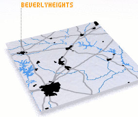 Places with similar names to Beverly Heights, United States - USA ::
// Beverly Heights (US)
// Beverly Heights (US)
// Beverly Heights (US)
// Beverly Heights (US)
// Beverly Heights (US)
Disclaimer :: Information on this page comes without warranty of any kind |
||
|
Where is Beverly Heights? Elevation and coordinates ::
Latitude (lat): 35°48'33"N Longitude (lon): 80°54'16"W
Elevation (approx.): 274m (map arrows pan, magnifying glasses zoom) |
||
|
Visiting Beverly Heights? Hotel/Accommodation ::
Book a hotel in Beverly Heights Travel Guide ::
rental cars ::
car rental offers GPS waypoint ::
download a GPX waypoint (PoI) of Beverly Heights for your GPS receiver
|
||