|
search place name
|
||
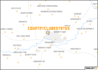
Country Club Estates (North Carolina, United States - USA)Country Club Estates is a town in the North Carolina region of United States - USA. An overview map of the region around Country Club Estates is displayed below.
regional and 3d topo map of Country Club Estates, United States - USA ::
Country Club Estates airports ::
The nearest airport is GSB - Goldsboro Seymour Johnson Afb, located 33.2 km west of Country Club Estates.
Other airports nearby include EWN - New Bern Craven Co Rgnl (55.8 km south east), NCA - Jacksonville New River Mcas (64.6 km south), NKT - Cherry Point Mcas (77.9 km south east), ILM - Wilmington Intl (114.8 km south), Nearby towns ::
Hines Junction (1.6km south west) //
Kinston (2.4km south east) //
Rivermont (4.0km south) //
Dupreeville (4.1km south) //
Harveytown (3.5km east) //
Georgetown (4.9km east) //
Parrott Fork (6.1km south) //
Jacksons Crossroads (6.9km south west) //
Heath (6.4km east) //
Mewborns Crossroads (7.9km north) //
Southwood (8.1km south east) //
Dawson (8.3km north) //
Loftins Crossroads (9.2km south east) //
Albrittons (10.3km south west) //
Wheat Swamp (10.0km north west) //
[all distances 'as the bird flies' and approximate] 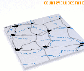 Places with similar names to Country Club Estates, United States - USA ::
// Country Club Estates (US)
// Country Club Estates (US)
// Country Club Estates (US)
// Country Club Estates (US)
// Country Club Estates (US)
// Country Club Estates (US)
// Country Club Estates (US)
// Country Club Estates (US)
// Country Club Estates (US)
// Country Club Estates (US)
Disclaimer :: Information on this page comes without warranty of any kind |
||
|
Where is Country Club Estates? Elevation and coordinates ::
Latitude (lat): 35°16'31"N Longitude (lon): 77°36'13"W
Elevation (approx.): 27m (map arrows pan, magnifying glasses zoom) |
||
|
Visiting Country Club Estates? Hotel/Accommodation ::
Book a hotel in Country Club Estates Travel Guide ::
rental cars ::
car rental offers GPS waypoint ::
download a GPX waypoint (PoI) of Country Club Estates for your GPS receiver
|
||