|
search place name
|
||
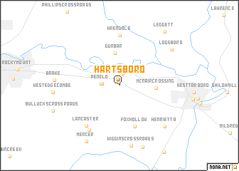
Hartsboro (North Carolina, United States - USA)Hartsboro is a town in the North Carolina region of United States - USA. An overview map of the region around Hartsboro is displayed below.
regional and 3d topo map of Hartsboro, United States - USA ::
Hartsboro airports ::
The nearest airport is GSB - Goldsboro Seymour Johnson Afb, located 69.9 km south west of Hartsboro.
Other airports nearby include RDU - Raleigh-durham Raleigh Durham Intl (103.1 km west), EWN - New Bern Craven Co Rgnl (108.3 km south east), NKT - Cherry Point Mcas (132.3 km south east), NCA - Jacksonville New River Mcas (135.2 km south), Nearby towns ::
Hartsease (1.9km north) //
Kungsboro (2.2km west) //
Penelo (2.4km west) //
Dunbar (5.1km north) //
McNair Crossing (4.6km east) //
Fox Hollow (6.7km south) //
Wrendale (7.9km north) //
Lancaster (7.6km south west) //
Hazelwood Park (8.0km south west) //
Henrietta (8.6km south east) //
Logsboro (8.7km north east) //
Mercer (9.7km south west) //
Leggett (10.2km north east) //
[all distances 'as the bird flies' and approximate]  Places with similar names to Hartsboro, United States - USA ::
// Hurtsboro (US)
Disclaimer :: Information on this page comes without warranty of any kind |
||
|
Where is Hartsboro? Elevation and coordinates ::
Latitude (lat): 35°54'55"N Longitude (lon): 77°38'48"W
Elevation (approx.): 40m (map arrows pan, magnifying glasses zoom) |
||
|
Visiting Hartsboro? Hotel/Accommodation ::
Book a hotel in Hartsboro Travel Guide ::
rental cars ::
car rental offers GPS waypoint ::
download a GPX waypoint (PoI) of Hartsboro for your GPS receiver
|
||