|
search place name
|
||
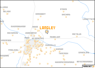
Langley (North Carolina, United States - USA)Langley is a town in the North Carolina region of United States - USA. An overview map of the region around Langley is displayed below.
regional and 3d topo map of Langley, United States - USA ::
Langley airports ::
The nearest airport is GSB - Goldsboro Seymour Johnson Afb, located 66.7 km south west of Langley.
Other airports nearby include EWN - New Bern Craven Co Rgnl (67.5 km south), NKT - Cherry Point Mcas (90.9 km south east), NCA - Jacksonville New River Mcas (103.5 km south), ECG - Elizabeth City Cgas Rgnl (124.5 km north east), Nearby towns ::
Shady Knoll Mobile Estates (2.6km south west) //
Buck Mobil Home Park (2.8km west) //
New Belden (3.1km south east) //
United Industrial Park (3.1km north west) //
Greenfield Terrace (3.3km north west) //
Green Springs (4.0km south west) //
Wilson Acres (4.0km south west) //
Speight (4.5km south) //
Hartington and Williams (4.5km south west) //
Johnston Heights (4.2km south west) //
Golden Place (5.0km south) //
House (4.4km north west) //
Meadowbrook (4.3km west) //
College Court (5.0km south west) //
Chatham Circle (4.7km south west) //
River Hills (5.4km south) //
Brook Valley (5.5km south) //
Ripple City (4.7km south west) //
Coghill (5.4km south west) //
Greenville (4.9km south west) //
College View (5.0km south west) //
Brook Green (5.3km south west) //
Easthaven (5.5km south west) //
Englewood (5.9km south west) //
Rock Springs (5.6km south west) //
Paramore Farm (6.3km south) //
Rolling Meadows (6.4km south) //
USAR Center (5.4km west) //
Forest Hills (6.1km south west) //
[all distances 'as the bird flies' and approximate]  Places with similar names to Langley, United States - USA ::
Disclaimer :: Information on this page comes without warranty of any kind |
||
|
Where is Langley? Elevation and coordinates ::
Latitude (lat): 35°38'12"N Longitude (lon): 77°19'17"W
Elevation (approx.): 8m (map arrows pan, magnifying glasses zoom) |
||
|
Visiting Langley? Hotel/Accommodation ::
Book a hotel in Langley Travel Guide ::
rental cars ::
car rental offers GPS waypoint ::
download a GPX waypoint (PoI) of Langley for your GPS receiver
|
||