|
search place name
|
||
Long Pine (North Carolina, United States - USA)Long Pine is a town in the North Carolina region of United States - USA. An overview map of the region around Long Pine is displayed below.
regional and 3d topo map of Long Pine, United States - USA ::

Long Pine airports ::
The nearest airport is CLT - Charlotte Douglas Intl, located 78.5 km north west of Long Pine.
Other airports nearby include FLO - Florence Rgnl (84.5 km south east), SSC - Sumter Shaw Afb (97.1 km south), POB - Fayetteville Pope Afb (117.1 km east), CAE - Colombia Columbia Metropolitan (128.0 km south west), Nearby towns ::
Littles Quarters (2.4km east) //
Mount Croghan (6.0km south) //
Maysville (5.6km east) //
Lowrys (6.6km north east) //
Hornsboro (6.4km south west) //
Maynards (7.4km south west) //
Deep Creek (6.9km north east) //
Wexford (7.8km south east) //
Ruby (9.6km south east) //
[all distances 'as the bird flies' and approximate] 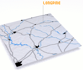 Places with similar names to Long Pine, United States - USA ::
// Lingapan (PH)
// Long Panai (MY)
// Long Pine (US)
// Longapan (ID)
// Làng Po No (LA)
// Lankupėnai (LT)
// Long Pine (US)
// Làng Pán (VN)
// Làng Pan (VN)
// Làng Pàn (VN)
Disclaimer :: Information on this page comes without warranty of any kind |
||
|
Where is Long Pine? Elevation and coordinates ::
Latitude (lat): 34°49'26"N Longitude (lon): 80°13'33"W
Elevation (approx.): 136m (map arrows pan, magnifying glasses zoom) |
||
|
Visiting Long Pine? Hotel/Accommodation ::
Book a hotel in Long Pine Travel Guide ::
rental cars ::
car rental offers GPS waypoint ::
download a GPX waypoint (PoI) of Long Pine for your GPS receiver
|
||