|
search place name
|
||
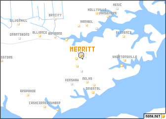
Merritt (North Carolina, United States - USA)Merritt is a town in the North Carolina region of United States - USA. An overview map of the region around Merritt is displayed below.
regional and 3d topo map of Merritt, United States - USA ::
Merritt airports ::
The nearest airport is NKT - Cherry Point Mcas, located 26.6 km south west of Merritt.
Other airports nearby include EWN - New Bern Craven Co Rgnl (30.1 km west), NCA - Jacksonville New River Mcas (79.1 km south west), GSB - Goldsboro Seymour Johnson Afb (116.6 km west), ECG - Elizabeth City Cgas Rgnl (138.0 km north), Nearby towns ::
Gibbton (1.2km west) //
Callisons (1.8km south west) //
Ashwood (2.7km south) //
Nelms (5.2km south) //
Stonewall (5.3km north west) //
Kershaw (5.9km south) //
Moores Corner (6.2km south) //
Swan Corner (7.5km north) //
Lynch Beach (7.4km north) //
Maribel (7.7km north) //
Oriental (7.7km south) //
Bayboro (7.1km north west) //
Pamlico (7.4km east) //
[all distances 'as the bird flies' and approximate] 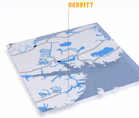 Places with similar names to Merritt, United States - USA ::
Disclaimer :: Information on this page comes without warranty of any kind |
||
|
Where is Merritt? Elevation and coordinates ::
Latitude (lat): 35°5'52"N Longitude (lon): 76°42'53"W
Elevation (approx.): 4m (map arrows pan, magnifying glasses zoom) |
||
|
Visiting Merritt? Hotel/Accommodation ::
Book a hotel in Merritt Travel Guide ::
rental cars ::
car rental offers GPS waypoint ::
download a GPX waypoint (PoI) of Merritt for your GPS receiver
|
||