|
search place name
|
||
Montreat (North Carolina, United States - USA)Montreat is a town in the North Carolina region of United States - USA. An overview map of the region around Montreat is displayed below.
regional and 3d topo map of Montreat, United States - USA ::

Montreat airports ::
The nearest airport is HKY - Hickory Rgnl, located 83.4 km east of Montreat.
Other airports nearby include CLT - Charlotte Douglas Intl (132.4 km east), AND - Andersen Anderson Rgnl (132.8 km south), TYS - Knoxville Mc Ghee Tyson (154.1 km west), CAE - Colombia Columbia Metropolitan (218.0 km south east), Nearby towns ::
Ridgecrest (3.2km south east) //
Black Mountain (3.4km south west) //
Walkertown (3.4km west) //
Coleman (4.5km east) //
Graphite (5.0km east) //
Grovestone (6.8km south west) //
Dendron (6.6km east) //
Flat Top (11.0km south west) //
[all distances 'as the bird flies' and approximate] 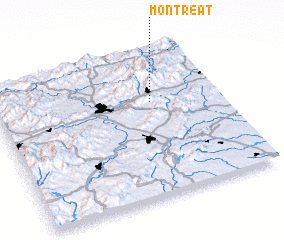 Places with similar names to Montreat, United States - USA ::
// Manattee Road (US)
// Minderreuti (DE)
// Mintard (DE)
// Monterotto (IT)
// Manta Rota (PT)
// Méntrida (ES)
// Monterde (ES)
// Montuerto (ES)
// Mount Road (ZA)
// Mandraty (MG)
Disclaimer :: Information on this page comes without warranty of any kind |
||
|
Where is Montreat? Elevation and coordinates ::
Latitude (lat): 35°38'39"N Longitude (lon): 82°18'11"W
Elevation (approx.): 805m (map arrows pan, magnifying glasses zoom) |
||
|
Visiting Montreat? Hotel/Accommodation ::
Book a hotel in Montreat Travel Guide ::
rental cars ::
car rental offers GPS waypoint ::
download a GPX waypoint (PoI) of Montreat for your GPS receiver
|
||