|
search place name
|
||
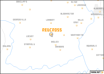
Red Cross (North Carolina, United States - USA)Red Cross is a town in the North Carolina region of United States - USA. An overview map of the region around Red Cross is displayed below.
regional and 3d topo map of Red Cross, United States - USA ::
Red Cross airports ::
The nearest airport is CLT - Charlotte Douglas Intl, located 53.8 km west of Red Cross.
Other airports nearby include INT - Winston-salem Smith Reynolds (96.9 km north), HKY - Hickory Rgnl (107.5 km north west), POB - Fayetteville Pope Afb (122.6 km east), FLO - Florence Rgnl (133.2 km south east), Nearby towns ::
 Places with similar names to Red Cross, United States - USA ::
// Rotkreuz (CH)
// Rio de Couros (PT)
// Red Cross (US)
// Redcross (US)
// Red Cross (US)
// Redcross (IE)
// Rooty Cross (IE)
Disclaimer :: Information on this page comes without warranty of any kind |
||
|
Where is Red Cross? Elevation and coordinates ::
Latitude (lat): 35°16'2"N Longitude (lon): 80°21'21"W
Elevation (approx.): 190m (map arrows pan, magnifying glasses zoom) |
||
|
Visiting Red Cross? Hotel/Accommodation ::
Book a hotel in Red Cross Travel Guide ::
rental cars ::
car rental offers GPS waypoint ::
download a GPX waypoint (PoI) of Red Cross for your GPS receiver
|
||