|
search place name
|
||
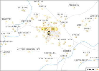
Rosebud (North Carolina, United States - USA)Rosebud is a town in the North Carolina region of United States - USA. An overview map of the region around Rosebud is displayed below.
regional and 3d topo map of Rosebud, United States - USA ::
Rosebud airports ::
The nearest airport is AND - Andersen Anderson Rgnl, located 92.1 km south of Rosebud.
Other airports nearby include HKY - Hickory Rgnl (110.0 km north east), CLT - Charlotte Douglas Intl (139.9 km east), TYS - Knoxville Mc Ghee Tyson (148.7 km north west), CAE - Colombia Columbia Metropolitan (195.8 km south east), Nearby towns ::
Willow Wew (0.4km north east) //
Country Club Estates (0.7km north west) //
Mountain Lake Camp (0.8km south) //
Valley Hill (0.7km south west) //
Overlook (0.9km north west) //
Willow Bend (1.0km east) //
Laurel Park Villas (1.2km north west) //
Lakewood (1.5km south west) //
Glenn Brook (1.8km north) //
Laurel Rock Acres (2.0km south) //
Echo Lakes (1.8km west) //
Chanteloupe Country Estates (1.9km south east) //
Laurel Park (2.0km north west) //
Echo Acres (1.9km west) //
Town Forest (2.3km north west) //
Brookdale (2.0km east) //
Hendersonville (2.3km north east) //
Kanuga Pines (2.7km south) //
Plantation Walk (2.9km north) //
Timberland (3.0km north) //
Brookland Manor (2.6km east) //
Tranquility (3.1km south) //
Druid Hills (3.3km north) //
Country Ridge (3.2km north west) //
Barker Heights (3.1km east) //
Terrace Gardens (4.1km north) //
Sky Village (3.5km north west) //
Essex (4.1km north) //
Indian Hills (4.3km north west) //
[all distances 'as the bird flies' and approximate]  Places with similar names to Rosebud, United States - USA ::
Disclaimer :: Information on this page comes without warranty of any kind |
||
|
Where is Rosebud? Elevation and coordinates ::
Latitude (lat): 35°18'7"N Longitude (lon): 82°28'35"W
Elevation (approx.): 663m (map arrows pan, magnifying glasses zoom) |
||
|
Visiting Rosebud? Hotel/Accommodation ::
Book a hotel in Rosebud Travel Guide ::
rental cars ::
car rental offers GPS waypoint ::
download a GPX waypoint (PoI) of Rosebud for your GPS receiver
|
||