|
search place name
|
||
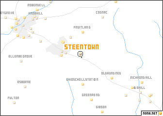
Steen Town (North Carolina, United States - USA)Steen Town is a town in the North Carolina region of United States - USA. An overview map of the region around Steen Town is displayed below.
regional and 3d topo map of Steen Town, United States - USA ::
Steen Town airports ::
The nearest airport is POB - Fayetteville Pope Afb, located 67.1 km north east of Steen Town.
Other airports nearby include FLO - Florence Rgnl (76.3 km south), CLT - Charlotte Douglas Intl (123.7 km west), SSC - Sumter Shaw Afb (124.8 km south west), RDU - Raleigh-durham Raleigh Durham Intl (136.6 km north east), Nearby towns ::
East Hamlet (3.2km west) //
New Town (3.9km west) //
Hamlet (4.0km west) //
Highland Park (5.2km north west) //
North Hamlet (5.0km north west) //
Dobbins Heights (5.2km north west) //
Fruitland (5.9km north) //
Ghio Scholl Station (6.1km south) //
Old Hundred (7.4km south east) //
[all distances 'as the bird flies' and approximate]  Places with similar names to Steen Town, United States - USA ::
Disclaimer :: Information on this page comes without warranty of any kind |
||
|
Where is Steen Town? Elevation and coordinates ::
Latitude (lat): 34°52'16"N Longitude (lon): 79°39'12"W
Elevation (approx.): 113m (map arrows pan, magnifying glasses zoom) |
||
|
Visiting Steen Town? Hotel/Accommodation ::
Book a hotel in Steen Town Travel Guide ::
rental cars ::
car rental offers GPS waypoint ::
download a GPX waypoint (PoI) of Steen Town for your GPS receiver
|
||