|
search place name
|
||
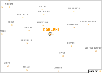
Adelphi (Ohio, United States - USA)Adelphi is a town in the Ohio region of United States - USA. An overview map of the region around Adelphi is displayed below.
regional and 3d topo map of Adelphi, United States - USA ::
Adelphi airports ::
The nearest airport is LCK - Columbus Rickenbacker Intl, located 41.5 km north of Adelphi.
Other airports nearby include CMH - Port Columbus Intl (60.3 km north), FFO - Dayton Wright Patterson Afb (118.6 km west), DAY - James M Cox Dayton Intl (135.2 km west), LUK - Cincinnati Muni Lunken Fld (149.7 km west), Nearby towns ::
Laurelville (1.0km north east) //
Stringtown (4.7km north west) //
Haynes (6.8km south east) //
Apple (7.9km south east) //
Whisler (6.6km west) //
Huntsville (8.4km north) //
South Perry (7.3km north east) //
Hallsville (7.3km west) //
[all distances 'as the bird flies' and approximate] 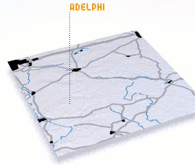 Places with similar names to Adelphi, United States - USA ::
// Adolfów (PL)
// Atolovo (BG)
// Adileva (RU)
// Adolfo (MX)
// Adolfo (MZ)
// Adelfia (IT)
// Adolfo (BR)
// Aḑ Ḑalfa‘ah (SA)
// Aït el Aïaf (MA)
// Aït Oualef (MA)
Disclaimer :: Information on this page comes without warranty of any kind |
||
|
Where is Adelphi? Elevation and coordinates ::
Latitude (lat): 39°28'0"N Longitude (lon): 82°44'50"W
Elevation (approx.): 255m (map arrows pan, magnifying glasses zoom) |
||
|
Visiting Adelphi? Hotel/Accommodation ::
Book a hotel in Adelphi Travel Guide ::
rental cars ::
car rental offers GPS waypoint ::
download a GPX waypoint (PoI) of Adelphi for your GPS receiver
|
||