|
search place name
|
||
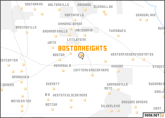
Boston Heights (Ohio, United States - USA)Boston Heights is a town in the Ohio region of United States - USA. An overview map of the region around Boston Heights is displayed below.
regional and 3d topo map of Boston Heights, United States - USA ::
Boston Heights airports ::
The nearest airport is AKR - Akron Fulton Intl, located 25.5 km south of Boston Heights.
Other airports nearby include CLE - Cleveland Hopkins Intl (32.6 km north west), YNG - Youngstown Warren Rgnl (69.9 km east), PIT - Pittsburgh (pennsylva) Pittsburgh Intl (137.9 km south east), YQG - Windsor (164.3 km north west), Nearby towns ::
Brandywine (2.4km north west) //
Little York (3.4km north) //
Chittendens Corners (4.0km south east) //
Peninsula (4.2km south west) //
Boston (3.9km west) //
Highland Springs (3.9km east) //
Macedonia (5.5km north) //
Northfield Center (5.9km north) //
Jaite (5.7km north west) //
Emmons Corner (7.1km north) //
Sagamore Hills (7.0km north west) //
Hudson (6.7km south east) //
Everett (8.3km south west) //
Twinsburg (8.1km north east) //
Metz (9.0km south east) //
Darrowville (9.2km south east) //
[all distances 'as the bird flies' and approximate] 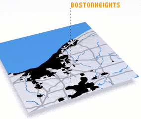 Places with similar names to Boston Heights, United States - USA :: Disclaimer :: Information on this page comes without warranty of any kind |
||
|
Where is Boston Heights? Elevation and coordinates ::
Latitude (lat): 41°15'53"N Longitude (lon): 81°30'48"W
Elevation (approx.): 327m (map arrows pan, magnifying glasses zoom) |
||
|
Visiting Boston Heights? Hotel/Accommodation ::
Book a hotel in Boston Heights Travel Guide ::
rental cars ::
car rental offers GPS waypoint ::
download a GPX waypoint (PoI) of Boston Heights for your GPS receiver
|
||