|
search place name
|
||
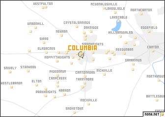
Columbia (Ohio, United States - USA)Columbia is a town in the Ohio region of United States - USA. An overview map of the region around Columbia is displayed below.
regional and 3d topo map of Columbia, United States - USA ::
Columbia airports ::
The nearest airport is AKR - Akron Fulton Intl, located 28.6 km north of Columbia.
Other airports nearby include CLE - Cleveland Hopkins Intl (75.0 km north), YNG - Youngstown Warren Rgnl (88.6 km north east), PIT - Pittsburgh (pennsylva) Pittsburgh Intl (113.8 km east), CMH - Port Columbus Intl (145.3 km south west), Nearby towns ::
West Park (0.6km west) //
Massillon (1.5km north) //
West Massillon (1.5km north west) //
Lawndale (1.6km west) //
Walnut Hills (1.9km east) //
New England (2.3km north east) //
Westarado (2.2km south west) //
Sippo Heights (3.0km north east) //
East Brookfield (3.0km north west) //
Mayflower Village (3.1km north west) //
Canton Road (4.1km south) //
Clearview (4.5km north) //
Amherst Heights (5.2km north) //
West Brookfield (4.3km west) //
Perry Heights (4.3km east) //
Tarrymore (5.6km south) //
Moffitt Heights (4.4km west) //
Greenwood Acres (5.8km north) //
Ingold Heights (4.8km east) //
Richville (5.2km south east) //
Genoa (4.7km east) //
Oak Ridge (6.4km north) //
Navarre (6.6km south) //
Pigeon Run (5.7km south west) //
Westland Park (5.3km east) //
Newman (6.4km north west) //
Edgewood Park (5.5km east) //
Crystal Springs (7.4km north) //
Camp Creek (6.9km south west) //
[all distances 'as the bird flies' and approximate] 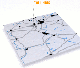 Places with similar names to Columbia, United States - USA ::
Disclaimer :: Information on this page comes without warranty of any kind |
||
|
Where is Columbia? Elevation and coordinates ::
Latitude (lat): 40°47'1"N Longitude (lon): 81°31'22"W
Elevation (approx.): 297m (map arrows pan, magnifying glasses zoom) |
||
|
Visiting Columbia? Hotel/Accommodation ::
Book a hotel in Columbia Travel Guide ::
rental cars ::
car rental offers GPS waypoint ::
download a GPX waypoint (PoI) of Columbia for your GPS receiver
|
||