|
search place name
|
||
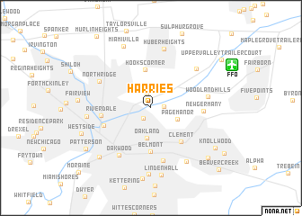
Harries (Ohio, United States - USA)Harries is a town in the Ohio region of United States - USA. An overview map of the region around Harries is displayed below.
regional and 3d topo map of Harries, United States - USA ::
Harries airports ::
The nearest airport is FFO - Dayton Wright Patterson Afb, located 9.4 km north east of Harries.
Other airports nearby include DAY - James M Cox Dayton Intl (15.4 km north west), LUK - Cincinnati Muni Lunken Fld (78.7 km south), CVG - Cincinnati Northern Kentucky Intl (92.9 km south west), LCK - Columbus Rickenbacker Intl (103.8 km east), Nearby towns ::
East Dayton (1.5km south west) //
Riverside (1.3km east) //
Avondale (1.7km north) //
Page Manor (2.8km south east) //
Oakland (3.8km south) //
Hooks Corner (4.8km north) //
Belmont (5.4km south) //
Clement (5.1km south east) //
Riverdale (4.8km west) //
Dayton (5.0km south west) //
New Germany (5.0km east) //
Shakertown (6.6km south) //
Oakwood (6.6km south west) //
Woodland Hills (5.6km east) //
Northridge (5.9km north west) //
Huber Mobile Home Park (6.5km north east) //
Huber Heights (7.4km north) //
Mount Saint John (7.4km south east) //
Daytonview (6.3km west) //
Beavertown (8.3km south) //
Miami Villa (8.1km north) //
Lindenhall (8.4km south) //
Carmonte (7.8km south west) //
Pasadena (8.8km south) //
West Side (7.4km south west) //
Knollwood (7.9km south east) //
Valleywood (8.2km south east) //
Patterson (8.0km south west) //
Upper Valley Trailer Court (9.0km north east) //
[all distances 'as the bird flies' and approximate]  Places with similar names to Harries, United States - USA ::
Disclaimer :: Information on this page comes without warranty of any kind |
||
|
Where is Harries? Elevation and coordinates ::
Latitude (lat): 39°46'41"N Longitude (lon): 84°8'20"W
Elevation (approx.): 246m (map arrows pan, magnifying glasses zoom) |
||
|
Visiting Harries? Hotel/Accommodation ::
Book a hotel in Harries Travel Guide ::
rental cars ::
car rental offers GPS waypoint ::
download a GPX waypoint (PoI) of Harries for your GPS receiver
|
||