|
search place name
|
||
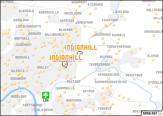
Indian Hill (Ohio, United States - USA)Indian Hill is a town in the Ohio region of United States - USA. An overview map of the region around Indian Hill is displayed below.
regional and 3d topo map of Indian Hill, United States - USA ::
Indian Hill airports ::
The nearest airport is LUK - Cincinnati Muni Lunken Fld, located 10.7 km south west of Indian Hill.
Other airports nearby include CVG - Cincinnati Northern Kentucky Intl (31.5 km south west), FFO - Dayton Wright Patterson Afb (76.1 km north), DAY - James M Cox Dayton Intl (80.8 km north), LCK - Columbus Rickenbacker Intl (140.7 km north east), Nearby towns ::
South Clippinger (0.7km south west) //
Madeira (1.9km north west) //
Al Bar Meadows (2.5km south west) //
Country Club Acres (2.9km west) //
Kenwood (3.8km north west) //
Indian Hill (3.6km south west) //
Kenwood Hills (3.5km south west) //
East Madisonville (3.8km south west) //
Plainville (4.5km south) //
Avoca Park (4.7km south) //
Harewood Acres (3.8km north west) //
Raiders Run (4.5km north west) //
Terrace Park (4.1km south east) //
Holiday Acres (4.1km north west) //
Mariemont (4.7km south west) //
Kenwood Knolls (4.8km north west) //
Montgomery (5.3km north) //
Shademoore (5.2km south west) //
Milford (4.4km east) //
Madisonville (4.7km south west) //
Ancor (5.4km south east) //
Clare (5.4km south west) //
Remington (5.6km north) //
Rossmoyne (5.1km north west) //
Barwyn Acres (5.7km north west) //
Deer Park (5.1km north west) //
Miamiville (5.3km north east) //
Silverton (4.9km west) //
Montgomery Heights (6.3km north) //
[all distances 'as the bird flies' and approximate] 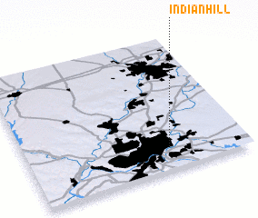 Places with similar names to Indian Hill, United States - USA ::
// Indian Hill (US)
// Indian Hill (US)
// Indian Hill (US)
// Indian Hill (US)
// Indian Hill (US)
// Indian Hill (US)
// Indian Hollow (US)
Disclaimer :: Information on this page comes without warranty of any kind |
||
|
Where is Indian Hill? Elevation and coordinates ::
Latitude (lat): 39°10'51"N Longitude (lon): 84°20'43"W
Elevation (approx.): 265m (map arrows pan, magnifying glasses zoom) |
||
|
Visiting Indian Hill? Hotel/Accommodation ::
Book a hotel in Indian Hill Travel Guide ::
rental cars ::
car rental offers GPS waypoint ::
download a GPX waypoint (PoI) of Indian Hill for your GPS receiver
|
||