|
search place name
|
||
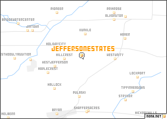
Jefferson Estates (Ohio, United States - USA)Jefferson Estates is a town in the Ohio region of United States - USA. An overview map of the region around Jefferson Estates is displayed below.
regional and 3d topo map of Jefferson Estates, United States - USA ::
Jefferson Estates airports ::
The nearest airport is YIP - Detroit Willow Run, located 108.2 km north east of Jefferson Estates.
Other airports nearby include DTW - Detroit Metro Wayne Co (117.9 km north east), LAN - Lansing Capital City (132.8 km north), YQG - Windsor (149.2 km north east), DET - Detroit Coleman A Young Muni (153.6 km north east), Nearby towns ::
Hillcrest (3.2km west) //
Kunkle (5.8km north) //
West Jefferson (5.0km west) //
Holiday City (5.3km north west) //
West Unity (5.3km east) //
Pulaski (8.3km south) //
Maplecrest (6.7km south west) //
Hallock (8.1km south west) //
[all distances 'as the bird flies' and approximate] 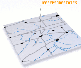 Places with similar names to Jefferson Estates, United States - USA ::
// Jefferson Estates (US)
Disclaimer :: Information on this page comes without warranty of any kind |
||
|
Where is Jefferson Estates? Elevation and coordinates ::
Latitude (lat): 41°35'6"N Longitude (lon): 84°29'56"W
Elevation (approx.): 257m (map arrows pan, magnifying glasses zoom) |
||
|
Visiting Jefferson Estates? Hotel/Accommodation ::
Book a hotel in Jefferson Estates Travel Guide ::
rental cars ::
car rental offers GPS waypoint ::
download a GPX waypoint (PoI) of Jefferson Estates for your GPS receiver
|
||