|
search place name
|
||
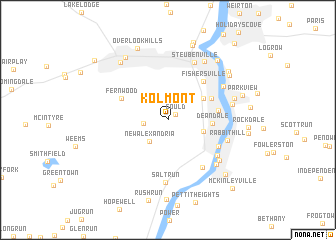
Kolmont (Ohio, United States - USA)Kolmont is a town in the Ohio region of United States - USA. An overview map of the region around Kolmont is displayed below.
regional and 3d topo map of Kolmont, United States - USA ::
Kolmont airports ::
The nearest airport is PIT - Pittsburgh (pennsylva) Pittsburgh Intl, located 41.4 km north east of Kolmont.
Other airports nearby include YNG - Youngstown Warren Rgnl (105.3 km north), AKR - Akron Fulton Intl (105.5 km north west), CLE - Cleveland Hopkins Intl (158.0 km north west), EKN - Elkins Randolph Co Jennings Randolph (172.4 km south east), Nearby towns ::
Gould (0.9km north east) //
Valley Glen (2.1km west) //
New Alexandria (2.9km south west) //
Georges Run (3.3km south east) //
Hillsboro (3.8km north east) //
Deandale (3.8km east) //
Altamont (4.4km north east) //
Fernwood (4.6km north west) //
Mingo Junction (4.5km east) //
Fishersville (5.2km north east) //
Lazearville (5.2km south east) //
Brilliant (6.0km south east) //
Shank Town (5.8km south east) //
Rabbit Hill (5.5km south east) //
Salt Run (7.0km south) //
Steubenville (6.8km north) //
Coketown (6.0km north east) //
Wellsburg (6.2km south east) //
Dutch Town (6.4km south east) //
Follansbee (5.8km east) //
La Belle View (7.3km north east) //
The Orchard (6.1km north east) //
Winterdale (7.6km north west) //
East Steubenville (7.2km north east) //
Wintersville (7.9km north west) //
Jacksonville (7.9km north east) //
Archer Heights (7.5km north east) //
Overlook Hills (8.4km north) //
Parkview (6.9km north east) //
[all distances 'as the bird flies' and approximate]  Places with similar names to Kolmont, United States - USA ::
// Calamintao (PH)
// Calmante (PH)
// Coalmont (US)
// Klement (AT)
// Coalmont (US)
// Claymont (US)
// Coalmont (US)
// Collimento (IT)
// Klementów (PL)
// Klimontów (PL)
Disclaimer :: Information on this page comes without warranty of any kind |
||
|
Where is Kolmont? Elevation and coordinates ::
Latitude (lat): 40°18'44"N Longitude (lon): 80°39'40"W
Elevation (approx.): 212m (map arrows pan, magnifying glasses zoom) |
||
|
Visiting Kolmont? Hotel/Accommodation ::
Book a hotel in Kolmont Travel Guide ::
rental cars ::
car rental offers GPS waypoint ::
download a GPX waypoint (PoI) of Kolmont for your GPS receiver
|
||