|
search place name
|
||
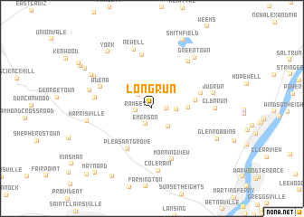
Long Run (Ohio, United States - USA)Long Run is a town in the Ohio region of United States - USA. An overview map of the region around Long Run is displayed below.
regional and 3d topo map of Long Run, United States - USA ::
Long Run airports ::
The nearest airport is PIT - Pittsburgh (pennsylva) Pittsburgh Intl, located 59.5 km north east of Long Run.
Other airports nearby include AKR - Akron Fulton Intl (108.6 km north west), YNG - Youngstown Warren Rgnl (118.9 km north), CLE - Cleveland Hopkins Intl (160.8 km north west), EKN - Elkins Randolph Co Jennings Randolph (166.7 km south east), Nearby towns ::
Dunglen (1.4km east) //
Ramsey (1.5km west) //
Emerson (2.0km south) //
Herrick (2.1km north west) //
Mount Pleasant (2.7km south east) //
Olszeski Town (2.3km east) //
Dillonvale (3.4km east) //
Pine Valley (4.2km east) //
Pleasant Grove (5.5km south west) //
Deyarmonville (5.0km east) //
Morningview (6.5km south) //
Piney Fork (6.7km north) //
Adena (5.5km north west) //
Robyville (5.6km west) //
Bradley (6.7km north east) //
Newell (7.5km north) //
Colerain (7.7km south) //
Glen Run (5.9km east) //
Jug Run (6.1km east) //
Hagan Addition (6.2km west) //
Harrisville (6.3km west) //
Belknap (6.7km north west) //
Greentown (7.4km north east) //
Chickwan (7.1km north west) //
York (8.1km north west) //
Glen Robbins (7.2km south east) //
Smithfield (8.9km north) //
Blairmont (8.0km north west) //
Crescent (9.1km south west) //
[all distances 'as the bird flies' and approximate] 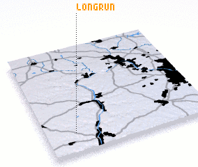 Places with similar names to Long Run, United States - USA ::
// Lǝnkǝran (AZ)
// Langgrün (DE)
// Lankern (DE)
// Long Run (US)
// Lanckorona (PL)
// Langueirón (ES)
// Langueirón (ES)
// Long Run (US)
// Long Green (US)
// Longrun (US)
Disclaimer :: Information on this page comes without warranty of any kind |
||
|
Where is Long Run? Elevation and coordinates ::
Latitude (lat): 40°11'42"N Longitude (lon): 80°48'57"W
Elevation (approx.): 246m (map arrows pan, magnifying glasses zoom) |
||
|
Visiting Long Run? Hotel/Accommodation ::
Book a hotel in Long Run Travel Guide ::
rental cars ::
car rental offers GPS waypoint ::
download a GPX waypoint (PoI) of Long Run for your GPS receiver
|
||