|
search place name
|
||
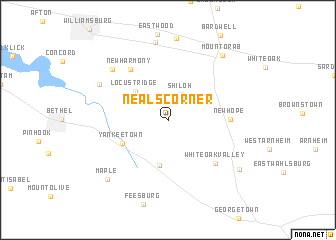
Neals Corner (Ohio, United States - USA)Neals Corner is a town in the Ohio region of United States - USA. An overview map of the region around Neals Corner is displayed below.
regional and 3d topo map of Neals Corner, United States - USA ::
Neals Corner airports ::
The nearest airport is LUK - Cincinnati Muni Lunken Fld, located 41.5 km west of Neals Corner.
Other airports nearby include CVG - Cincinnati Northern Kentucky Intl (60.8 km west), FFO - Dayton Wright Patterson Afb (96.1 km north), DAY - James M Cox Dayton Intl (106.4 km north), LCK - Columbus Rickenbacker Intl (130.6 km north east), Nearby towns ::
Shiloh (3.1km north) //
Locust Ridge (4.3km north west) //
Hamersville (5.1km south) //
Yankeetown (4.8km south west) //
New Hope (5.3km east) //
New Harmony (6.5km north west) //
White Oak Valley (6.3km south east) //
Hennings Mill (7.5km north west) //
Clover (7.2km north west) //
Andersonville (8.7km north) //
Mount Orab (8.6km north east) //
Maple (8.5km south west) //
Wahlsburg (8.2km south east) //
[all distances 'as the bird flies' and approximate] 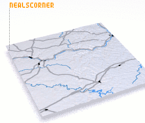 Places with similar names to Neals Corner, United States - USA ::
// Knowles Corner (US)
// Knowles Corner (US)
// Nealeys Corner (US)
// Neals Corner (US)
// Neals Corner (US)
// Nilles Corner (US)
Disclaimer :: Information on this page comes without warranty of any kind |
||
|
Where is Neals Corner? Elevation and coordinates ::
Latitude (lat): 38°57'46"N Longitude (lon): 83°58'27"W
Elevation (approx.): 282m (map arrows pan, magnifying glasses zoom) |
||
|
Visiting Neals Corner? Hotel/Accommodation ::
Book a hotel in Neals Corner Travel Guide ::
rental cars ::
car rental offers GPS waypoint ::
download a GPX waypoint (PoI) of Neals Corner for your GPS receiver
|
||