|
search place name
|
||
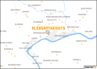
Pleasant Heights (Ohio, United States - USA)Pleasant Heights is a town in the Ohio region of United States - USA. An overview map of the region around Pleasant Heights is displayed below.
regional and 3d topo map of Pleasant Heights, United States - USA ::
Pleasant Heights airports ::
The nearest airport is PIT - Pittsburgh (pennsylva) Pittsburgh Intl, located 34.0 km south east of Pleasant Heights.
Other airports nearby include YNG - Youngstown Warren Rgnl (70.2 km north), AKR - Akron Fulton Intl (86.6 km north west), CLE - Cleveland Hopkins Intl (136.9 km north west), EKN - Elkins Randolph Co Jennings Randolph (203.4 km south), Nearby towns ::
Jethro (0.9km south west) //
La Croft (1.7km north west) //
East Liverpool (1.8km south east) //
Newell (2.0km south west) //
Walkers (2.6km south west) //
Spring Grove (2.5km west) //
Chester (3.1km south east) //
Mount Acres Trailer Park (4.2km north) //
Calcutta (4.7km north) //
Lawrenceville (4.2km south east) //
Glenmoor (4.7km north west) //
Twin Oaks Trailer Park (4.6km north west) //
Glendale (4.4km east) //
Lennyville (4.9km south west) //
Congo (4.8km south west) //
Dry Run (4.6km east) //
Cannons Mill (5.9km north) //
East End (4.6km east) //
Shadybrook Trailer Park (6.5km north east) //
Grimms Bridge (6.3km north east) //
Wellsville (6.0km south west) //
Hillcrest (5.8km west) //
Sprucevale (8.3km north) //
Fairhaven (8.2km south) //
Brownsdale Mobile Home Park (8.7km south west) //
Vulcan (7.9km south west) //
Rock Camp (9.3km north west) //
Yellow Creek (9.2km south west) //
Campus (10.2km north west) //
[all distances 'as the bird flies' and approximate]  Places with similar names to Pleasant Heights, United States - USA ::
// Pleasant Heights (US)
// Pleasant Heights (US)
Disclaimer :: Information on this page comes without warranty of any kind |
||
|
Where is Pleasant Heights? Elevation and coordinates ::
Latitude (lat): 40°37'56"N Longitude (lon): 80°35'21"W
Elevation (approx.): 366m (map arrows pan, magnifying glasses zoom) |
||
|
Visiting Pleasant Heights? Hotel/Accommodation ::
Book a hotel in Pleasant Heights Travel Guide ::
rental cars ::
car rental offers GPS waypoint ::
download a GPX waypoint (PoI) of Pleasant Heights for your GPS receiver
|
||