|
search place name
|
||
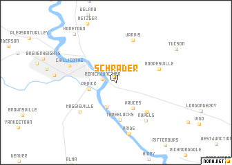
Schrader (Ohio, United States - USA)Schrader is a town in the Ohio region of United States - USA. An overview map of the region around Schrader is displayed below.
regional and 3d topo map of Schrader, United States - USA ::
Schrader airports ::
The nearest airport is LCK - Columbus Rickenbacker Intl, located 56.2 km north of Schrader.
Other airports nearby include CMH - Port Columbus Intl (76.6 km north), FFO - Dayton Wright Patterson Afb (113.1 km north west), DAY - James M Cox Dayton Intl (130.1 km north west), LUK - Cincinnati Muni Lunken Fld (131.9 km west), Nearby towns ::
Renick Junction (1.7km west) //
Deadman Crossing (4.1km south) //
Renick (3.6km west) //
Vauces (4.7km south east) //
Three Locks (6.1km south) //
Schooley (6.1km south east) //
Jarvis (7.1km north) //
Mooresville (5.9km east) //
Massieville (6.6km south west) //
Rupels (7.3km south east) //
Chillicothe (6.5km north west) //
Pride (8.4km south) //
Hopetown (9.4km north west) //
[all distances 'as the bird flies' and approximate] 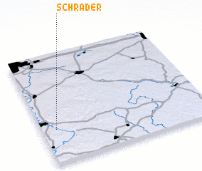 Places with similar names to Schrader, United States - USA ::
// Secretário (BR)
// Secretario (PA)
// Zacarter (US)
// Secretary (US)
// Schroeder (US)
// Sugartree (US)
// Sugartree (US)
// Sugar Tree (US)
// Schroeder (US)
// Sagardari (TD)
Disclaimer :: Information on this page comes without warranty of any kind |
||
|
Where is Schrader? Elevation and coordinates ::
Latitude (lat): 39°18'29"N Longitude (lon): 82°54'52"W
Elevation (approx.): 187m (map arrows pan, magnifying glasses zoom) |
||
|
Visiting Schrader? Hotel/Accommodation ::
Book a hotel in Schrader Travel Guide ::
rental cars ::
car rental offers GPS waypoint ::
download a GPX waypoint (PoI) of Schrader for your GPS receiver
|
||