|
search place name
|
||
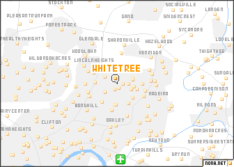
Whitetree (Ohio, United States - USA)Whitetree is a town in the Ohio region of United States - USA. An overview map of the region around Whitetree is displayed below.
regional and 3d topo map of Whitetree, United States - USA ::
Whitetree airports ::
The nearest airport is LUK - Cincinnati Muni Lunken Fld, located 12.2 km south of Whitetree.
Other airports nearby include CVG - Cincinnati Northern Kentucky Intl (27.9 km south west), FFO - Dayton Wright Patterson Afb (75.3 km north east), DAY - James M Cox Dayton Intl (78.5 km north), LCK - Columbus Rickenbacker Intl (144.9 km north east), Nearby towns ::
Rolling Knolls Estate (0.7km south) //
Arbocrest Acres (0.8km east) //
Amberley (1.0km south) //
North Sagamore Heights (1.3km east) //
Brookwood (2.0km south west) //
Reading (1.9km north west) //
Amity (1.9km south east) //
Dillonvale (1.9km east) //
Dillionvale (2.2km north east) //
Beechwood (2.2km east) //
Pleasant Ridge (3.3km south) //
Deer Park (2.7km east) //
Silverton (3.0km south east) //
Dallmans Corner (3.5km south) //
Arlington Heights (2.7km west) //
Kennedy Heights (3.4km south east) //
Golf Manor (3.5km south west) //
Rossmoyne (3.2km east) //
Lockland (3.4km north west) //
Norwood Heights (4.3km south) //
Lincoln Heights (3.9km north west) //
Holiday Acres (3.7km east) //
Harewood Acres (3.9km south east) //
Roselawn (3.9km south west) //
Edgemont (3.8km west) //
Evendale (4.8km north) //
Hartwell (3.9km west) //
Wyoming (4.1km north west) //
Stratford Manor (5.3km south) //
[all distances 'as the bird flies' and approximate] 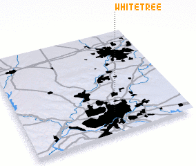 Places with similar names to Whitetree, United States - USA ::
// White Deer (US)
// White Deer (US)
// Hutaduru (ID)
// Hato de Oro (MX)
// Hat'aedo-ri (KR)
// Haut-Ittre (BE)
// Huutotöyry (FI)
Disclaimer :: Information on this page comes without warranty of any kind |
||
|
Where is Whitetree? Elevation and coordinates ::
Latitude (lat): 39°12'48"N Longitude (lon): 84°25'26"W
Elevation (approx.): 253m (map arrows pan, magnifying glasses zoom) |
||
|
Visiting Whitetree? Hotel/Accommodation ::
Book a hotel in Whitetree Travel Guide ::
rental cars ::
car rental offers GPS waypoint ::
download a GPX waypoint (PoI) of Whitetree for your GPS receiver
|
||