|
search place name
|
||
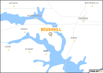
Brush Hill (Oklahoma, United States - USA)Brush Hill is a town in the Oklahoma region of United States - USA. An overview map of the region around Brush Hill is displayed below.
regional and 3d topo map of Brush Hill, United States - USA ::
Brush Hill airports ::
The nearest airport is MLC - Mcalester Mc Alester Rgnl, located 61.3 km south of Brush Hill.
Other airports nearby include TUL - Tulsa Intl (89.5 km north), FSM - Fort Smith Rgnl (114.9 km east), FYV - Fayetteville Drake Fld (147.0 km north east), TIK - Oklahoma City Tinker Afb (159.7 km west), Nearby towns ::
Fame (6.6km south) //
Onapa (7.0km east) //
Richardsville (8.0km north west) //
Stidham (8.6km south west) //
[all distances 'as the bird flies' and approximate]  Places with similar names to Brush Hill, United States - USA ::
// Bouir Chleh (MA)
// Brecholey (CH)
// Barchel (DE)
// Borchel (DE)
// Bracial (PT)
// Bīrīshūl (IR)
// Būrā Chālū (IR)
// Brush Hollow (US)
// Berch Hole (US)
// Bara Chāla (BD)
Disclaimer :: Information on this page comes without warranty of any kind |
||
|
Where is Brush Hill? Elevation and coordinates ::
Latitude (lat): 35°25'12"N Longitude (lon): 95°37'41"W
Elevation (approx.): 195m (map arrows pan, magnifying glasses zoom) |
||
|
Visiting Brush Hill? Hotel/Accommodation ::
Book a hotel in Brush Hill Travel Guide ::
rental cars ::
car rental offers GPS waypoint ::
download a GPX waypoint (PoI) of Brush Hill for your GPS receiver
|
||