|
search place name
|
||
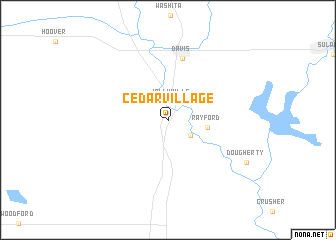
Cedar Village (Oklahoma, United States - USA)Cedar Village is a town in the Oklahoma region of United States - USA. An overview map of the region around Cedar Village is displayed below.
regional and 3d topo map of Cedar Village, United States - USA ::
Cedar Village airports ::
The nearest airport is TIK - Oklahoma City Tinker Afb, located 110.3 km north of Cedar Village.
Other airports nearby include OKC - Oklahoma City Will Rogers World (113.8 km north), FSI - Fort Sill Henry Post Aaf (118.7 km west), MLC - Mcalester Mc Alester Rgnl (133.1 km east), SPS - Sheppard Afb Wichita Falls Muni (134.9 km west), Nearby towns ::
Jollyville (2.1km north) //
Falls Creek Assembly (2.8km south east) //
Rayford (3.7km east) //
Davis (7.0km north) //
Dougherty (8.6km south east) //
[all distances 'as the bird flies' and approximate] 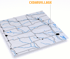 Places with similar names to Cedar Village, United States - USA ::
Disclaimer :: Information on this page comes without warranty of any kind |
||
|
Where is Cedar Village? Elevation and coordinates ::
Latitude (lat): 34°26'32"N Longitude (lon): 97°8'2"W
Elevation (approx.): 258m (map arrows pan, magnifying glasses zoom) |
||
|
Visiting Cedar Village? Hotel/Accommodation ::
Book a hotel in Cedar Village Travel Guide ::
rental cars ::
car rental offers GPS waypoint ::
download a GPX waypoint (PoI) of Cedar Village for your GPS receiver
|
||