|
search place name
|
||
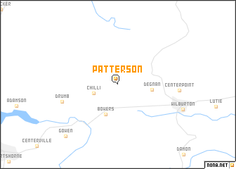
Patterson (Oklahoma, United States - USA)Patterson is a town in the Oklahoma region of United States - USA. An overview map of the region around Patterson is displayed below.
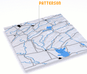
regional and 3d topo map of Patterson, United States - USA ::
Patterson airports ::
The nearest airport is MLC - Mcalester Mc Alester Rgnl, located 35.8 km west of Patterson.
Other airports nearby include FSM - Fort Smith Rgnl (103.3 km north east), TUL - Tulsa Intl (144.9 km north), FYV - Fayetteville Drake Fld (161.5 km north east), TIK - Oklahoma City Tinker Afb (187.9 km west), Nearby towns ::
 Places with similar names to Patterson, United States - USA ::
Disclaimer :: Information on this page comes without warranty of any kind |
||
|
Where is Patterson? Elevation and coordinates ::
Latitude (lat): 34°57'17"N Longitude (lon): 95°24'5"W
Elevation (approx.): 224m (map arrows pan, magnifying glasses zoom) |
||
|
Visiting Patterson? Hotel/Accommodation ::
Book a hotel in Patterson Travel Guide ::
rental cars ::
car rental offers GPS waypoint ::
download a GPX waypoint (PoI) of Patterson for your GPS receiver
|
||