|
search place name
|
||
Roberta (Oklahoma, United States - USA)Roberta is a town in the Oklahoma region of United States - USA. An overview map of the region around Roberta is displayed below.
regional and 3d topo map of Roberta, United States - USA ::

Roberta airports ::
The nearest airport is MLC - Mcalester Mc Alester Rgnl, located 116.3 km north east of Roberta.
Other airports nearby include DAL - Dallas Love Fld (130.2 km south west), DFW - Dallas-fort Worth Dallas Fort Worth Intl (133.1 km south west), FTW - Fort Worth Meacham Intl (157.5 km south west), TIK - Oklahoma City Tinker Afb (192.7 km north west), Nearby towns ::
Old Allison (5.9km south west) //
Pirtle (7.7km north east) //
Allison (7.2km south west) //
Lee Heights (8.8km north west) //
Durant (9.8km north west) //
Blue (10.3km north east) //
[all distances 'as the bird flies' and approximate] 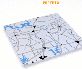 Places with similar names to Roberta, United States - USA ::
Disclaimer :: Information on this page comes without warranty of any kind |
||
|
Where is Roberta? Elevation and coordinates ::
Latitude (lat): 33°55'35"N Longitude (lon): 96°18'8"W
Elevation (approx.): 206m (map arrows pan, magnifying glasses zoom) |
||
|
Visiting Roberta? Hotel/Accommodation ::
Book a hotel in Roberta Travel Guide ::
rental cars ::
car rental offers GPS waypoint ::
download a GPX waypoint (PoI) of Roberta for your GPS receiver
|
||