|
search place name
|
||
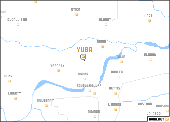
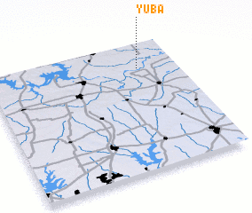
Yuba (Oklahoma, United States - USA)Yuba is a town in the Oklahoma region of United States - USA. An overview map of the region around Yuba is displayed below.
regional and 3d topo map of Yuba, United States - USA ::
Yuba airports ::
The nearest airport is DAL - Dallas Love Fld, located 122.6 km south west of Yuba.
Other airports nearby include MLC - Mcalester Mc Alester Rgnl (125.2 km north), DFW - Dallas-fort Worth Dallas Fort Worth Intl (127.5 km south west), FTW - Fort Worth Meacham Intl (153.9 km south west), TYR - Tyler Pounds Rgnl (177.9 km south east), Nearby towns ::
 Places with similar names to Yuba, United States - USA ::
Disclaimer :: Information on this page comes without warranty of any kind |
||
|
Where is Yuba? Elevation and coordinates ::
Latitude (lat): 33°48'34"N Longitude (lon): 96°12'15"W
Elevation (approx.): 155m (map arrows pan, magnifying glasses zoom) |
||
|
Visiting Yuba? Hotel/Accommodation ::
Book a hotel in Yuba Travel Guide ::
rental cars ::
car rental offers GPS waypoint ::
download a GPX waypoint (PoI) of Yuba for your GPS receiver
|
||