|
search place name
|
||
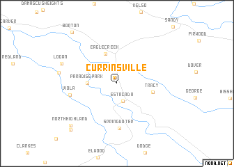
Currinsville (Oregon, United States - USA)Currinsville is a town in the Oregon region of United States - USA. An overview map of the region around Currinsville is displayed below.
regional and 3d topo map of Currinsville, United States - USA ::
Currinsville airports ::
The nearest airport is PDX - Portland Intl, located 36.4 km north west of Currinsville.
Other airports nearby include MMV - Mackminnville Mc Minnville Muni (63.8 km west), GRF - Fort Lewis Gray Aaf (196.9 km north), TCM - Tacoma Mc Chord Afb (202.8 km north), Nearby towns ::
Estacada (2.9km south) //
Paradise Park (3.3km west) //
Eagle Creek (4.9km north) //
Tracy (4.3km east) //
Springwater (7.2km south) //
Viola (5.6km west) //
North Highland (8.6km south west) //
Highland (9.1km south west) //
Barton (9.6km north west) //
[all distances 'as the bird flies' and approximate]  Places with similar names to Currinsville, United States - USA ::
// Cronese Valley (US)
// Carnesville (US)
// Crownsville (US)
// Cranesville (US)
// Cranesville (US)
// Kernsville (US)
// Koron-e Soflá (IR)
// Cranesville (US)
// Kearneysville (US)
Disclaimer :: Information on this page comes without warranty of any kind |
||
|
Where is Currinsville? Elevation and coordinates ::
Latitude (lat): 45°18'55"N Longitude (lon): 122°20'29"W
Elevation (approx.): 141m (map arrows pan, magnifying glasses zoom) |
||
|
Visiting Currinsville? Hotel/Accommodation ::
Book a hotel in Currinsville Travel Guide ::
rental cars ::
car rental offers GPS waypoint ::
download a GPX waypoint (PoI) of Currinsville for your GPS receiver
|
||