|
search place name
|
||
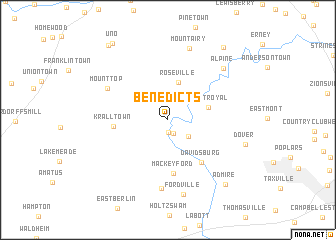
Benedicts (Pennsylvania, United States - USA)Benedicts is a town in the Pennsylvania region of United States - USA. An overview map of the region around Benedicts is displayed below.
regional and 3d topo map of Benedicts, United States - USA ::
Benedicts airports ::
The nearest airport is MDT - Harrisburg Intl, located 23.3 km north east of Benedicts.
Other airports nearby include MUI - Muir Aaf (54.7 km north east), APG - Aberdeen Phillips Aaf (90.1 km south east), BWI - Baltimore Washington Intl (97.1 km south), ILG - Wilmington New Castle (119.5 km east), Nearby towns ::
Detters Mill (1.4km south) //
Roler (1.6km south) //
Harmony Grove (2.5km south east) //
Wellsville (2.8km north) //
Roseville (4.2km north) //
Mount Royal (3.7km east) //
Mackey Ford (6.0km south) //
Davidsburg (5.6km south east) //
Kralltown (4.7km west) //
Mount Top (6.3km north west) //
Big Mountain (7.7km south) //
Fortney (8.2km north) //
Mount Airy (8.2km north) //
Alpine (7.4km north east) //
Fordville (8.5km south) //
Dover (7.2km south east) //
Admire (8.7km south east) //
Maytown (9.4km north east) //
Uno (9.7km north west) //
Stevenstown (9.7km north west) //
[all distances 'as the bird flies' and approximate]  Places with similar names to Benedicts, United States - USA :: Disclaimer :: Information on this page comes without warranty of any kind |
||
|
Where is Benedicts? Elevation and coordinates ::
Latitude (lat): 40°1'36"N Longitude (lon): 76°55'42"W
Elevation (approx.): 130m (map arrows pan, magnifying glasses zoom) |
||
|
Visiting Benedicts? Hotel/Accommodation ::
Book a hotel in Benedicts Travel Guide ::
rental cars ::
car rental offers GPS waypoint ::
download a GPX waypoint (PoI) of Benedicts for your GPS receiver
|
||