|
search place name
|
||
Brownstown (Pennsylvania, United States - USA)Brownstown is a town in the Pennsylvania region of United States - USA. An overview map of the region around Brownstown is displayed below.
regional and 3d topo map of Brownstown, United States - USA ::

Brownstown airports ::
The nearest airport is PIT - Pittsburgh (pennsylva) Pittsburgh Intl, located 61.3 km west of Brownstown.
Other airports nearby include AOO - Altoona Blair Co (105.1 km east), YNG - Youngstown Warren Rgnl (126.1 km north west), AKR - Akron Fulton Intl (173.6 km west), EKN - Elkins Randolph Co Jennings Randolph (186.5 km south), Nearby towns ::
Truxall (2.3km west) //
Edmon (3.0km south east) //
Salina (3.2km south east) //
Perryville (4.0km south) //
Bell Point (3.2km west) //
Lambings (4.5km north) //
Orchard Hills (4.5km north) //
Cherry Lane (4.6km north west) //
Avonmore (4.9km south east) //
Hicksville (5.3km east) //
Spring Church (6.7km north) //
Apollo (5.8km north west) //
North Apollo (6.4km north west) //
Maysville (5.5km east) //
Paulton (5.8km north west) //
Wakena (7.1km south east) //
East Vandergrift (6.9km north west) //
Oklahoma (6.3km north west) //
Fairbanks (7.5km south) //
Foster (6.4km east) //
North Vandergrift (7.6km north west) //
Vandergrift (7.5km north west) //
Vandergrift Heights (7.3km north west) //
Kepple Hill (8.4km north west) //
Pleasant View (8.6km north west) //
River View (8.4km north west) //
Saltsburg (8.6km south east) //
West Vandergrift (8.3km north west) //
Shady Plain (9.5km north east) //
[all distances 'as the bird flies' and approximate] 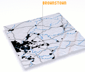 Places with similar names to Brownstown, United States - USA ::
// Brownstown (US)
// Burnstown (US)
// Bernstein (AT)
// Brownstown (US)
// Bärenstein (DE)
// Bärenstein (DE)
// Barnstein (DE)
// Bärnstein (DE)
// Barrenstein (DE)
// Bernstein (DE)
Disclaimer :: Information on this page comes without warranty of any kind |
||
|
Where is Brownstown? Elevation and coordinates ::
Latitude (lat): 40°32'54"N Longitude (lon): 79°30'48"W
Elevation (approx.): 415m (map arrows pan, magnifying glasses zoom) |
||
|
Visiting Brownstown? Hotel/Accommodation ::
Book a hotel in Brownstown Travel Guide ::
rental cars ::
car rental offers GPS waypoint ::
download a GPX waypoint (PoI) of Brownstown for your GPS receiver
|
||