|
search place name
|
||
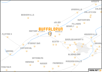
Buffalo Run (Pennsylvania, United States - USA)Buffalo Run is a town in the Pennsylvania region of United States - USA. An overview map of the region around Buffalo Run is displayed below.
regional and 3d topo map of Buffalo Run, United States - USA ::
Buffalo Run airports ::
The nearest airport is AOO - Altoona Blair Co, located 66.4 km south west of Buffalo Run.
Other airports nearby include IPT - Williamsport Rgnl (98.9 km north east), MDT - Harrisburg Intl (123.7 km south east), MUI - Muir Aaf (125.7 km east), IAD - Washington Dulles Intl (213.6 km south), Nearby towns ::
Matternville (0.4km north west) //
Ridgemont (1.1km east) //
Waddle (2.4km east) //
Marysville (3.3km south) //
Scotia (3.5km south east) //
Julian (4.4km north east) //
Martha Furnace (3.9km west) //
Park Forest Village (4.5km south east) //
Stormstown (6.0km south west) //
Circle Ville (6.4km south east) //
Briarly (6.1km north east) //
Park Hills (6.3km south east) //
Overlook Heights (7.0km east) //
Pine Hall (8.7km south east) //
Beaver Mills (9.3km north west) //
Bloomsdorf (10.4km south east) //
[all distances 'as the bird flies' and approximate]  Places with similar names to Buffalo Run, United States - USA ::
// Bāgh Ali Arāīn (PK)
Disclaimer :: Information on this page comes without warranty of any kind |
||
|
Where is Buffalo Run? Elevation and coordinates ::
Latitude (lat): 40°49'42"N Longitude (lon): 77°57'45"W
Elevation (approx.): 401m (map arrows pan, magnifying glasses zoom) |
||
|
Visiting Buffalo Run? Hotel/Accommodation ::
Book a hotel in Buffalo Run Travel Guide ::
rental cars ::
car rental offers GPS waypoint ::
download a GPX waypoint (PoI) of Buffalo Run for your GPS receiver
|
||