|
search place name
|
||
Cedar Heights (Pennsylvania, United States - USA)Cedar Heights is a town in the Pennsylvania region of United States - USA. An overview map of the region around Cedar Heights is displayed below.
regional and 3d topo map of Cedar Heights, United States - USA ::

Cedar Heights airports ::
The nearest airport is NXX - Willow Grove Nas Jrb, located 17.6 km north east of Cedar Heights.
Other airports nearby include PHL - Philadelphia Intl (23.9 km south), TTN - Trenton Mercer (45.9 km north east), ILG - Wilmington New Castle (52.5 km south west), WRI - Wrightstown Mc Guire Afb (60.1 km east), Nearby towns ::
Harmonville (1.3km north) //
Spring Mill (1.2km south east) //
Conshohocken (1.2km south west) //
West Spring Mills (1.8km south) //
Seven Stars (2.0km north west) //
Mill Road (2.0km north west) //
Andorra Woods (2.0km east) //
Plymouth Meeting (2.4km north east) //
Connaughtown (2.1km west) //
Barren Hill (2.3km east) //
Corsons (3.0km north east) //
Cherry Dale (2.4km east) //
Ivy Rock (2.5km north west) //
Hickorytown (3.3km north) //
West Conshohocken (2.8km south west) //
Black Horse (3.2km north west) //
Cold Point (3.4km north east) //
Mechanicsville (3.2km south west) //
Mogeetown (3.3km north west) //
Miquon (3.4km south east) //
Ernest (3.3km north west) //
Lafayette (3.9km south east) //
Mogees Station (3.7km north west) //
Marble Hall (3.3km east) //
Swedeland (3.6km west) //
Swedesburg (4.0km north west) //
Gladwyne (4.9km south) //
Gulph Terrace (4.4km south west) //
Roseglen (5.0km south east) //
[all distances 'as the bird flies' and approximate] 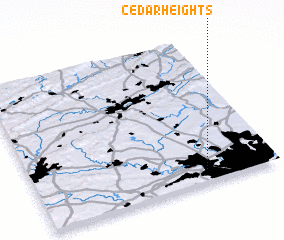 Places with similar names to Cedar Heights, United States - USA ::
// Cedar Heights (US)
// Cedar Heights (US)
// Cedar Heights (US)
// Cedar Heights (US)
// Cedar Heights (US)
Disclaimer :: Information on this page comes without warranty of any kind |
||
|
Where is Cedar Heights? Elevation and coordinates ::
Latitude (lat): 40°5'3"N Longitude (lon): 75°17'23"W
Elevation (approx.): 67m (map arrows pan, magnifying glasses zoom) |
||
|
Visiting Cedar Heights? Hotel/Accommodation ::
Book a hotel in Cedar Heights Travel Guide ::
rental cars ::
car rental offers GPS waypoint ::
download a GPX waypoint (PoI) of Cedar Heights for your GPS receiver
|
||