|
search place name
|
||
Ceylon (Pennsylvania, United States - USA)Ceylon is a town in the Pennsylvania region of United States - USA. An overview map of the region around Ceylon is displayed below.
regional and 3d topo map of Ceylon, United States - USA ::

Ceylon airports ::
The nearest airport is PIT - Pittsburgh (pennsylva) Pittsburgh Intl, located 73.1 km north of Ceylon.
Other airports nearby include EKN - Elkins Randolph Co Jennings Randolph (108.5 km south), AOO - Altoona Blair Co (149.6 km east), YNG - Youngstown Warren Rgnl (166.2 km north), AKR - Akron Fulton Intl (181.5 km north west), Nearby towns ::
Little Chicago (1.7km east) //
Paisley (2.2km east) //
Fairdale (3.0km north) //
Carmichaels (3.9km north) //
Neil Corner (4.2km north) //
Cumberland Village (4.3km north) //
Sigsbee (4.3km south east) //
Live Easy (3.7km east) //
Headlee Heights (5.3km south) //
Mount Sterling (4.3km south east) //
Willow Tree (5.9km south) //
Nemacolin (5.1km east) //
Khedive (5.3km north west) //
Ronco (5.2km east) //
Huron (5.4km east) //
Stringtown (6.4km north east) //
Garards Fort (6.5km south west) //
Cats Run Junction (6.0km south east) //
Adah (6.3km north east) //
Mapletown (7.1km south east) //
Grays Landing (6.2km south east) //
Fayette (6.9km south east) //
Gallatin (6.8km south east) //
Gates (6.7km north east) //
Palmer (7.6km north east) //
Sunshine (7.5km south east) //
Antram (7.8km north east) //
Fieldsons Crossroads (8.7km south east) //
Dry Tavern (9.0km north) //
[all distances 'as the bird flies' and approximate] 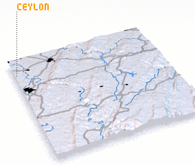 Places with similar names to Ceylon, United States - USA ::
Disclaimer :: Information on this page comes without warranty of any kind |
||
|
Where is Ceylon? Elevation and coordinates ::
Latitude (lat): 39°51'43"N Longitude (lon): 79°58'51"W
Elevation (approx.): 287m (map arrows pan, magnifying glasses zoom) |
||
|
Visiting Ceylon? Hotel/Accommodation ::
Book a hotel in Ceylon Travel Guide ::
rental cars ::
car rental offers GPS waypoint ::
download a GPX waypoint (PoI) of Ceylon for your GPS receiver
|
||