|
search place name
|
||
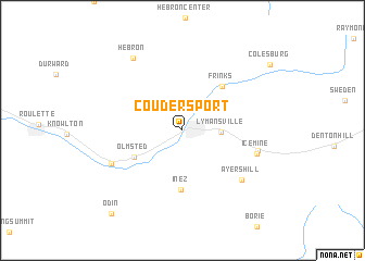
Coudersport (Pennsylvania, United States - USA)Coudersport is a town in the Pennsylvania region of United States - USA. An overview map of the region around Coudersport is displayed below.
regional and 3d topo map of Coudersport, United States - USA ::
Coudersport airports ::
The nearest airport is IPT - Williamsport Rgnl, located 109.2 km south east of Coudersport.
Other airports nearby include BUF - Buffalo Niagara Intl (142.1 km north west), ROC - Greater Rochester Intl (152.0 km north), AOO - Altoona Blair Co (166.1 km south), IAG - Niagara Falls Intl (166.5 km north west), Nearby towns ::
Lymansville (3.0km east) //
Olmsted (4.6km south west) //
Frinks (5.4km north east) //
Inez (6.1km south) //
Ayers Hill (6.9km south east) //
Ice Mine (6.2km south east) //
Sweden Valley (6.2km east) //
Mina (6.4km south west) //
Hebron (8.4km north west) //
Odin (10.2km south west) //
[all distances 'as the bird flies' and approximate] 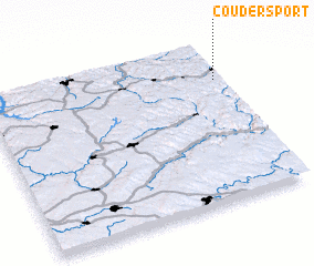 Places with similar names to Coudersport, United States - USA :: Disclaimer :: Information on this page comes without warranty of any kind |
||
|
Where is Coudersport? Elevation and coordinates ::
Latitude (lat): 41°46'29"N Longitude (lon): 78°1'15"W
Elevation (approx.): 504m (map arrows pan, magnifying glasses zoom) |
||
|
Visiting Coudersport? Hotel/Accommodation ::
Book a hotel in Coudersport Travel Guide ::
rental cars ::
car rental offers GPS waypoint ::
download a GPX waypoint (PoI) of Coudersport for your GPS receiver
|
||