|
search place name
|
||
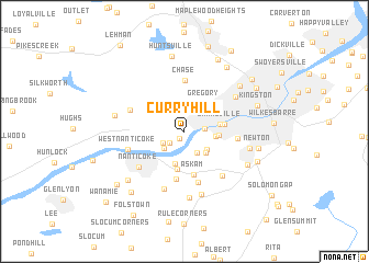
Curry Hill (Pennsylvania, United States - USA)Curry Hill is a town in the Pennsylvania region of United States - USA. An overview map of the region around Curry Hill is displayed below.
regional and 3d topo map of Curry Hill, United States - USA ::
Curry Hill airports ::
The nearest airport is IPT - Williamsport Rgnl, located 80.3 km west of Curry Hill.
Other airports nearby include MUI - Muir Aaf (102.8 km south west), MDT - Harrisburg Intl (134.2 km south west), NXX - Willow Grove Nas Jrb (134.3 km south east), TTN - Trenton Mercer (144.3 km south east), Nearby towns ::
Johnson Greene (0.8km south west) //
Sickler Hill (1.6km south west) //
Plymouth (1.6km east) //
Avondale Hill (2.1km south west) //
Hanover Green (2.4km south east) //
Avondale (2.3km south west) //
Buttonwood (2.5km south east) //
Korn Krest (2.8km south east) //
Breslau (2.4km east) //
Dundee (3.4km south) //
Gregory (3.2km north east) //
Lynnwood (2.7km east) //
Larksville (2.8km east) //
Loomis Park (3.8km south) //
Plymouth Junction (3.2km east) //
Askam (4.4km south) //
Lower Askam (4.9km south) //
Chase (5.2km north) //
Warrior Run (5.3km south) //
Lee Park (4.1km east) //
Nanticoke (5.0km south west) //
Ceasetown (4.7km north west) //
Sugar Notch (5.4km south east) //
West Nanticoke (4.7km south west) //
Hanover (6.0km south) //
Edwardsville (5.3km north east) //
Witinski Villa (6.6km south) //
Truesdale Terrace (6.7km south) //
Franklin Junction (5.3km east) //
[all distances 'as the bird flies' and approximate] 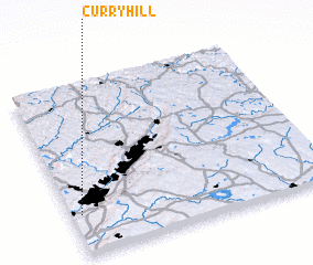 Places with similar names to Curry Hill, United States - USA ::
// Quarry Hill (BZ)
// Gray Hill (US)
// Curry Hill (US)
// Gray Hill (US)
// Kruhel (PL)
// Karahallı (TR)
// Kauru Hill (NZ)
// Kerr Hill (US)
// Corey Hill (US)
// Crow Hill (US)
Disclaimer :: Information on this page comes without warranty of any kind |
||
|
Where is Curry Hill? Elevation and coordinates ::
Latitude (lat): 41°14'17"N Longitude (lon): 75°57'49"W
Elevation (approx.): 213m (map arrows pan, magnifying glasses zoom) |
||
|
Visiting Curry Hill? Hotel/Accommodation ::
Book a hotel in Curry Hill Travel Guide ::
rental cars ::
car rental offers GPS waypoint ::
download a GPX waypoint (PoI) of Curry Hill for your GPS receiver
|
||