|
search place name
|
||
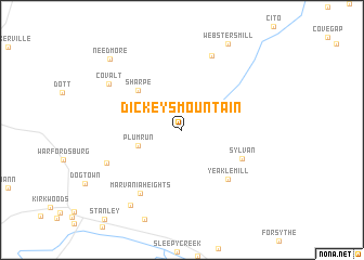
Dickeys Mountain (Pennsylvania, United States - USA)Dickeys Mountain is a town in the Pennsylvania region of United States - USA. An overview map of the region around Dickeys Mountain is displayed below.
regional and 3d topo map of Dickeys Mountain, United States - USA ::
Dickeys Mountain airports ::
The nearest airport is AOO - Altoona Blair Co, located 61.0 km north of Dickeys Mountain.
Other airports nearby include IAD - Washington Dulles Intl (107.1 km south east), MDT - Harrisburg Intl (121.3 km north east), DCA - Ronald Reagan Washington Natl (136.6 km south east), BWI - Baltimore Washington Intl (138.6 km south east), Nearby towns ::
Plum Run (3.8km south west) //
Sharpe (5.4km north west) //
Sylvan (5.6km south east) //
Yeakle Mill (6.3km south east) //
Marvania Heights (7.4km south west) //
Big Cove Tannery (8.1km north) //
Johnsons Mill (6.9km south west) //
Covalt (7.5km north west) //
Timber Ridge Heights (8.7km south west) //
Needmore (9.3km north west) //
[all distances 'as the bird flies' and approximate] 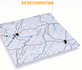 Places with similar names to Dickeys Mountain, United States - USA :: Disclaimer :: Information on this page comes without warranty of any kind |
||
|
Where is Dickeys Mountain? Elevation and coordinates ::
Latitude (lat): 39°46'47"N Longitude (lon): 78°4'40"W
Elevation (approx.): 165m (map arrows pan, magnifying glasses zoom) |
||
|
Visiting Dickeys Mountain? Hotel/Accommodation ::
Book a hotel in Dickeys Mountain Travel Guide ::
rental cars ::
car rental offers GPS waypoint ::
download a GPX waypoint (PoI) of Dickeys Mountain for your GPS receiver
|
||