|
search place name
|
||
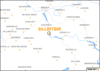
Dillontown (Pennsylvania, United States - USA)Dillontown is a town in the Pennsylvania region of United States - USA. An overview map of the region around Dillontown is displayed below.
regional and 3d topo map of Dillontown, United States - USA ::
Dillontown airports ::
The nearest airport is SWF - Newburgh Stewart Intl, located 104.9 km east of Dillontown.
Other airports nearby include TEB - Teterboro (151.6 km south east), SYR - Syracuse Hancock Intl (154.3 km north west), IPT - Williamsport Rgnl (154.6 km south west), ALB - Albany Intl (155.4 km north east), Nearby towns ::
Stockport (3.0km north) //
Equinunk (3.8km east) //
Lordville (4.2km east) //
High Lake (6.9km south west) //
East Spruce (6.1km south west) //
Lake Como (6.2km west) //
Starlight (6.7km north west) //
Peas Eddy (9.1km north) //
Autumn Leaves (8.8km north west) //
Priceville (8.8km south east) //
[all distances 'as the bird flies' and approximate]  Places with similar names to Dillontown, United States - USA ::
// Tuluntún (PA)
// Tallent Town (US)
// Tolentino (MX)
// Tolentino (MX)
// Talontan (NG)
// Tolentino (IT)
// Taal Nétan (VU)
// Tallandoon (AU)
// Tolentino (DO)
Disclaimer :: Information on this page comes without warranty of any kind |
||
|
Where is Dillontown? Elevation and coordinates ::
Latitude (lat): 41°52'7"N Longitude (lon): 75°16'0"W
Elevation (approx.): 293m (map arrows pan, magnifying glasses zoom) |
||
|
Visiting Dillontown? Hotel/Accommodation ::
Book a hotel in Dillontown Travel Guide ::
rental cars ::
car rental offers GPS waypoint ::
download a GPX waypoint (PoI) of Dillontown for your GPS receiver
|
||